Along Wisconsin's western edge, the shortcut is rarely the point. Highway 35 spends roughly 250 miles tracing the Mississippi River's east bank, and the route is the attraction. Wisconsin's stretch of the Great River Road is one of the oldest scenic byways of its kind in America, according to Travel Wisconsin, and in November it becomes one of the best bald-eagle drives in the Upper Midwest.
Wisconsin is home to 250 miles of the Great River Road, a corridor that follows the Mississippi more than 3,000 miles from the river's Minnesota headwaters toward the Gulf, Travel Wisconsin reports. The route was developed beginning in 1938, and the Federal Highway Administration has recognized the corridor as a National Scenic Byway; in 2021 it designated eight of the ten state routes, including Wisconsin's, as All-American Roads, according to the Great River Road history on Wikipedia.

A road built for slowing down
Most of the Wisconsin route follows Highway 35 south from Prescott, where the St. Croix River joins the Mississippi, winding through the bluff country of the state's unglaciated Driftless Area. The highway is Wisconsin's longest state route at 412 miles, much of it hugging the state's western border with Minnesota and Iowa.
The reward is a drive lined with sandstone bluffs, backwaters and river towns, with three state parks — Nelson Dewey, Perrot and Wyalusing — strung along the corridor, according to Travel Wisconsin. The byway also passes the Upper Mississippi River National Wildlife and Fish Refuge, which has a visitor center in Onalaska.

Stops worth the detour
Pepin and Stockholm. Lake Pepin, the river's wide natural lake, anchors this pair of villages about 16 miles apart. Pepin is the birthplace of author Laura Ingalls Wilder, whose story begins in the Little House in the Big Woods, and the lake is where water skiing was pioneered, according to Travel Wisconsin. Stockholm, founded in 1854 by immigrants from Sweden, has grown an arts-and-wine district around Villa Bellezza winery.
Nelson. The Nelson Cheese Factory, at S237 State Road 35, is a deli and cheese shop along the route — open daily from 9 a.m. to 5:30 p.m. — serving sandwiches, ice cream and a full Wisconsin cheese selection, per the factory's website.
Alma. The Buffalo County seat climbs the bluffs above Lock and Dam No. 4. A walking trail leads from downtown up to Buena Vista Park, 500 feet above the river, with a pavilion and picnic grills; a drive-up route from the back of the bluff works too, Travel Wisconsin says. Downtown's ten 19th-century stair-step streets connect the hilltop to Main Street. From November through March, the open water below the dam draws bald eagles, and shoreline viewing spots form Alma's "Eagles on Ice" circuit.

Trempealeau. Perrot State Park sits where the Trempealeau River joins the Mississippi, nestled among 500-foot bluffs, according to the Wisconsin DNR. Brady's Bluff rises 520 feet above the water, with Perrot Ridge close behind, and the park offers direct bike access to the 24-mile Great River State Trail. The Trempealeau pool below the bluffs draws bald eagles, tundra swans, geese and ducks, with an observation deck at the adjacent wildlife refuge.
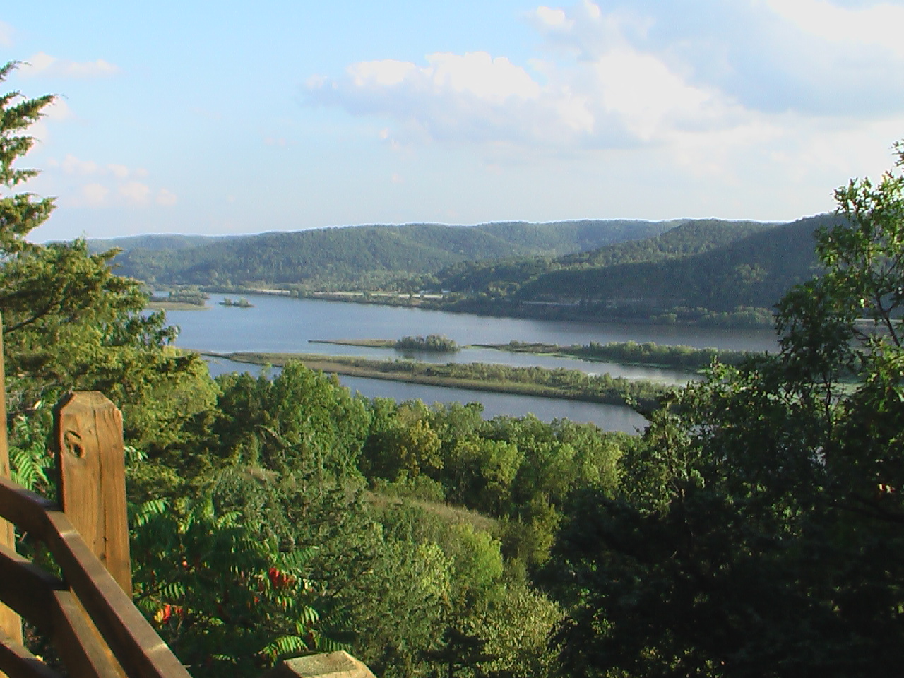
La Crosse. The largest city on the route sits between the river and the bluffs; Grandad Bluff offers what Travel Wisconsin calls the best city view of the Great River Road journey.
Prairie du Chien. French explorers Jacques Marquette and Louis Joliet reached the site by canoe on June 17, 1673, and the community — often called Wisconsin's second-oldest city — grew at the confluence of the Wisconsin and Mississippi rivers, a fur-trade crossroads for well over a century.
Cassville. Near the route's south end, Nelson Dewey State Park spreads across 500-foot bluffs above the river and is named for Wisconsin's first governor, whose Stonefield estate and restored farming village sit just outside the park. The eagle viewing around Lock and Dam No. 10 at Cassville ranks among the nation's most popular, with Riverside Park and the park overlooks as prime spots; clear, crisp winter mornings are best, Travel Wisconsin says.
If you go
November is prime eagle season: wintering birds congregate around open water as lakes and backwaters freeze, and Wisconsin ranks in the top five states for eagle populations, per the National Eagle Center. At Alma, open water below Lock and Dam No. 4 gives eagles easy fishing and viewers a front-row spot from shore.
Seasonal rhythm matters. The Nelson Cheese Factory stays open daily through the year, but many river attractions — boat tours, seasonal ferries and historic sites such as Stonefield — wind down by November. Confirm hours before setting out.

Sources
- Travel Wisconsin: Outdoor Fun on the Great River Road
- Travel Wisconsin: Views Worth the Trip Along the Great River Road
- Travel Wisconsin: Small Towns Along the Great River Road
- Travel Wisconsin: Know Before You Go — Bald Eagle Watching in Wisconsin
- Travel Wisconsin: Bald Eagle Watching — Cassville
- Travel Wisconsin: Alma Eagles on Ice
- Wikipedia: Wisconsin Highway 35
- Wikipedia: Great River Road
- Wisconsin DNR: Perrot State Park
- Nelson Cheese Factory
- U.S. Fish and Wildlife Service: Upper Mississippi River National Wildlife and Fish Refuge
- Wikipedia: Prairie du Chien, Wisconsin