Hoosier National Forest is not one continuous park with a single entrance. Its lands are scattered across southern Indiana, with private property and communities between them. That makes it a rewarding place to explore in pieces: choose one destination, bring a map and allow time to understand the landscape around you.
These three outings offer very different experiences, from a sandstone canyon to a historic lookout and a protected stand of old forest. Check the U.S. Forest Service for current alerts, road conditions and rules before leaving. Wear suitable footwear, carry water, tell someone your route and stay on the appropriate public trails.
1. Hemlock Cliffs: Sandstone, Shade and Seasonal Waterfalls
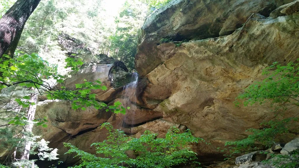
Hemlock Cliffs is a box-shaped canyon known for sandstone formations, rock shelters and waterfalls that depend on rainfall. The Forest Service provides a trail map for the area; download or carry it before leaving, because a map can help you stay on public land and understand where the route goes.
The trail offers a close look at the canyon’s rock and wooded setting, but the experience changes with weather. Waterfalls may be modest or absent in dry conditions, while rain can make footing slick and increase the difficulty of the walk. Plan for uneven surfaces, watch children closely and stay away from cliff edges.
The official map identifies restrictions on climbing, rappelling, camping and fires in the protected area. Follow signs and current Forest Service rules rather than assuming that an inviting rock face is open to exploration. Leave plants, stones and cultural resources where you find them.
A good visit does not require scrambling into every recess. Stop along the designated trail, look at the layers of sandstone and notice how the vegetation changes with shade and moisture. Give the walk enough time that you can choose your footing and enjoy the canyon without hurrying.
2. Hickory Ridge Lookout and the Deam Wilderness
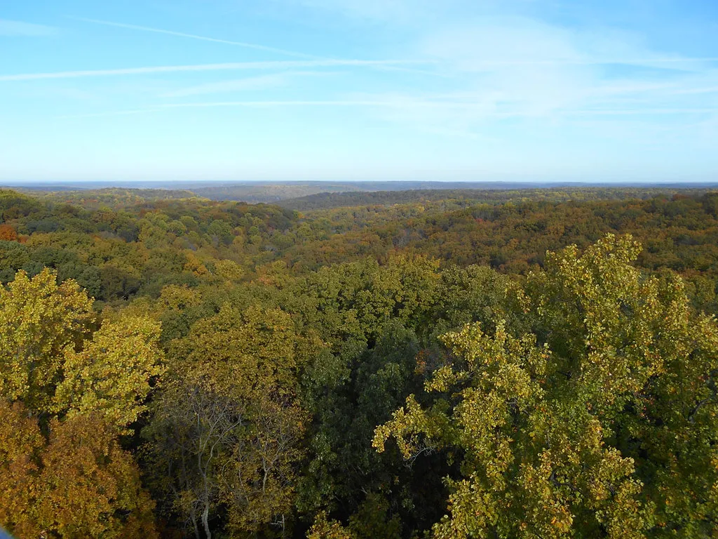
Hickory Ridge Lookout Tower stands near the Charles C. Deam Wilderness and preserves a piece of forest-management history. According to the Forest Service, Civilian Conservation Corps crews built the tower in 1939, and it was used for fire detection until the 1970s. It is the last remaining lookout tower on the Hoosier National Forest.
The historic tower has a long staircase, and its availability can change. Do not assume the tower or its upper cab is open: check the Forest Service’s current information and obey posted closures. Visitors who prefer to stay on the ground can still consider the tower’s role in detecting wildfires and the work involved in watching a large landscape.
The surrounding Deam Wilderness offers a more demanding outing for hikers prepared with a map and a suitable route. Public and private lands can be interspersed, and forest trails vary in length and permitted uses. Confirm your route, carry navigation and emergency supplies, and avoid making a long wilderness hike an improvised addition to a short tower stop.
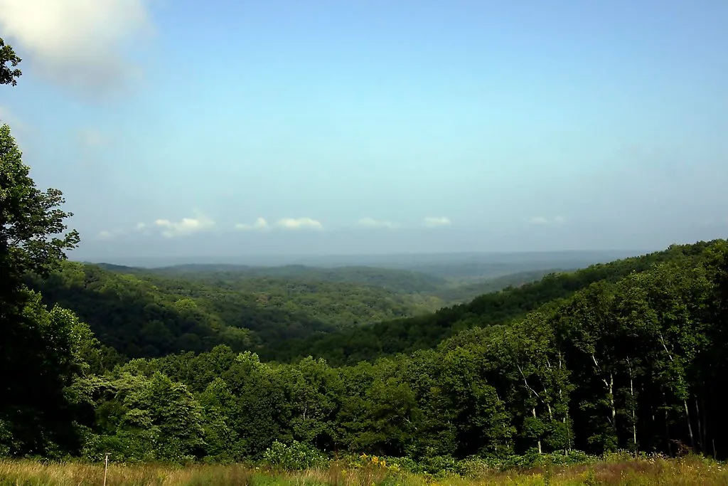
In hunting seasons, the Forest Service recommends visible blaze orange. Weather, daylight and trail conditions should shape the day’s plan. The view in the photo was taken from the tower; visitors should not expect that vantage point to be available when a closure is in effect.
3. Pioneer Mothers Memorial Forest: A Walk Among Old Trees
Near Paoli, Pioneer Mothers Memorial Forest protects an old-growth stand and an archeological site. The Forest Service describes an approximately 1.3-mile hiking trail through the area and identifies the tract as a Research Natural Area. It is a place for a slower walk beneath mature trees rather than a destination for collecting souvenirs.
Start with the Forest Service map and directions to a designated trailhead. The agency notes parking access from Indiana 37 and U.S. 150; check current conditions and use the specific location that fits your route. Carry water, choose sturdy shoes and leave enough time to follow the trail without cutting across vegetation.
Special protections apply here. The Forest Service prohibits activities including camping, horses, bicycles and plant collecting in the research natural area. Archeological resources are protected as well: do not disturb a site or remove an object, and report a possible find to the Forest Service.
Look for the variety of mature hardwoods and consider how much time it takes for a forest to develop. The Forest Service explains that community fundraising helped save this tract from logging before it was designated for research protection. Respect for the place today helps preserve its ecological and historical value for visitors and researchers who follow.
The three sites in this guide are separated by rural roads; they do not need to be combined in a single day. Choose the stop that best matches your group and the forecast, confirm the route and enjoy a part of southern Indiana at a pace that leaves room to look around.