Kentucky's waterfalls can feel like entirely different destinations even when they share a general region. One spreads across a broad river, another requires a rugged trail above a gorge, and a third drops past a huge rock shelter in Big South Fork. Each is a reason to slow down, but each also asks visitors to plan for different conditions.
Cumberland Falls, Eagle Falls and Yahoo Falls are not a promise of identical scenery on every visit. Rainfall and season change the flow, and trail conditions can shift quickly. Use this guide to choose the outing that fits your group, then check the managing agency's current information before leaving.
1. Cumberland Falls: The Big River View
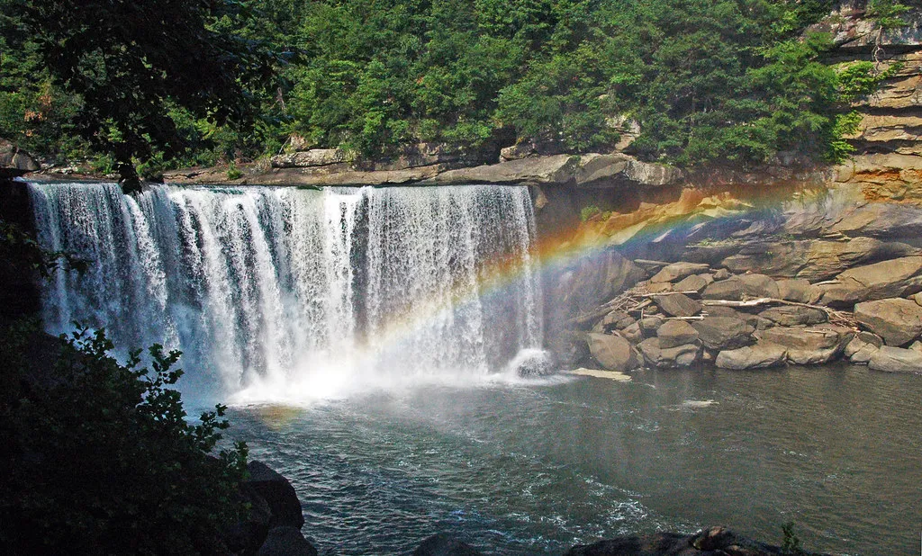
Cumberland Falls is the centerpiece of Cumberland Falls State Resort Park near Corbin. The Cumberland River spreads over a broad ledge into a misty gorge, and the park's designated viewing areas offer a chance to experience the force and sound of the water without committing to a long hike.
Allow time for more than a quick stop. Look at the river above the drop, listen to the water and notice how the light changes the mist. The scene after sustained rain can be very different from a dry-season visit. Stay behind barriers and keep children close; the moving water and wet rocks are dangerous places for an improvised shortcut.
The park is also known for a moonbow, a lunar rainbow that can appear around a full moon when conditions cooperate. Kentucky State Parks publishes a calendar, but cloud cover and other conditions can prevent a sighting. Check current night-viewing instructions, and do not treat a planned moonbow date as a guarantee.
For an overnight trip, verify facilities before booking. The park's published notice says DuPont Lodge and the Riverview Restaurant closed for renovation effective December 1, 2025, while cabins remain available. Check directly for the latest status and alternative meals.
2. Eagle Falls: A Rugged Trail With Another View
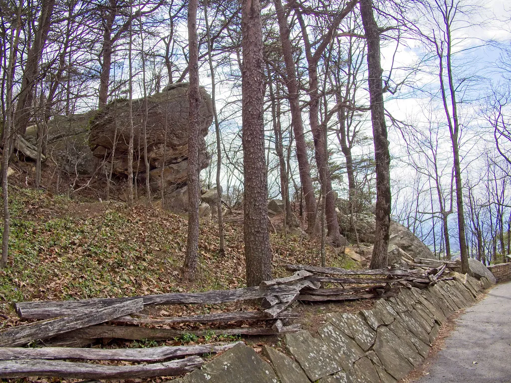
Eagle Falls is reached by Trail 9 at Cumberland Falls State Resort Park. The state describes the trail as approximately 1.8 miles and notes that hikers follow a cliff line for much of the route, with views toward Cumberland Falls. After a seasonal stream crossing, the route becomes a loop with a spur toward the river.
This is a different undertaking from visiting the main waterfall overlook. The park warns that the latter section is rugged and that the lower trail can be underwater during high water. Check conditions with staff, use the current trail map and turn back if the route is flooded or unsuitable. Never try to cross moving water simply to finish a planned loop.
Wear shoes with traction, carry water and allow enough daylight for a careful return. Kentucky State Parks' general guidance says trails are open from sunrise to sunset unless otherwise noted. A moonbow viewing trip should not become an unplanned night hike on this trail.
The park also restricts pets on the McCreary County side because the land is a dedicated state nature preserve. Contact the park about the specific route before bringing an animal, and follow posted rules. A great photograph is never a reason to leave the trail or approach a cliff edge.
3. Yahoo Falls: A Tall Drop and a Rock Shelter
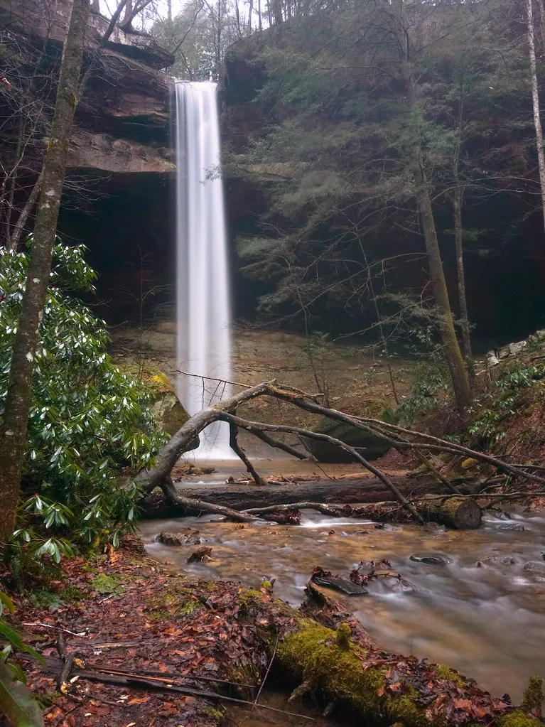
Yahoo Falls lies in the Kentucky portion of Big South Fork National River and Recreation Area. The National Park Service describes a 113-foot waterfall and a loop route that passes behind the falls beneath a large rock shelter. It is a different kind of scenery from Cumberland's broad river curtain: water descends over a high ledge into a wooded hollow.
The park calls the route generally easy apart from very steep metal steps. Those steps are an important part of the decision, particularly for visitors uncomfortable with heights or stairs. Review the current map and ask a ranger about conditions before going; a short route should not be mistaken for a level or accessible one.
Water flow is strongly affected by weather. The park notes that the volume can be greatly reduced during dry periods, so a dramatic photograph from a wetter season may not predict what you will see. Even with less water, the rock shelter and forest can be rewarding when the trail is safe and open.
Big South Fork spans Kentucky and Tennessee, and services can be seasonal. Check which visitor contact station is open, carry water and use reliable directions to the trailhead. Stay on established paths, especially near the ledge and wet ground beneath the falls.
Which One Should You Choose?
For a first family outing centered on a major viewpoint, Cumberland Falls is the most direct introduction. Eagle Falls is better for a group prepared for a rugged hike and changing water conditions. Yahoo Falls offers a tall drop and a distinctive shelter, with steep steps that deserve honest consideration.
They can inspire more than one trip. Rather than trying to drive and hike everything in a single day, choose a base, check the weather and leave room to enjoy the place you select. Each managing agency provides maps, alerts and rules that should guide the final plan.
Before You Leave
Check recent weather, trail and road notices, visitor-center hours and any facility closures. Bring layers, water and footwear appropriate for slippery surfaces. Keep a safe distance from fast water, avoid walking onto wet ledges and follow all posted barriers. A careful plan lets the waterfall be the memorable part of the day.