The distance from Selma to Montgomery can be covered in a relatively short drive. Understanding the struggle that unfolded along that route takes more time. In 1965, marchers traveled on foot from Selma through Alabama’s Black Belt to the state capitol, demanding the right to vote without the obstacles and violence that had long kept Black citizens from the ballot box.
Today, the Selma to Montgomery National Historic Trail follows the 54-mile route of the successful march. You can explore it by car, with stops at places that put the march into a wider story of local organizing, federal protection and communities that continued to fight for change afterward. The route passes through living cities and neighborhoods, so plan time to listen, read and treat each place with the care it deserves.
These five stops are arranged generally from west to east. Check the National Park Service’s current alerts and operating hours before setting out, and confirm interior access directly with independent churches or other property operators.
1. Brown Chapel AME Church: Where the March Began
Begin at Brown Chapel African Methodist Episcopal Church in Selma, an important gathering place for meetings during the voting rights movement. The National Park Service identifies the church as the starting point of the historic march route. Its location in a residential neighborhood is a reminder that the movement grew out of everyday community life as well as nationally known speeches and events.
Before leaving, look at a trail map and consider the journey ahead. The march was not simply a spontaneous walk between two cities. Organizers and residents built networks, held meetings, and faced resistance while demanding a voice in decisions that shaped their lives. The church stood within that network of meeting places and relationships.
Brown Chapel is an active church, not an attraction with guaranteed walk-in admission. View it respectfully, avoid interrupting worship or private activity, and contact the church or a local visitor center in advance if you hope to arrange a visit inside.
2. Edmund Pettus Bridge: Remember Bloody Sunday
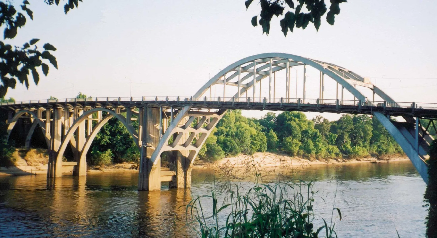
The Edmund Pettus Bridge carries U.S. Highway 80 across the Alabama River at Selma. On March 7, 1965, law enforcement officers violently confronted nonviolent voting rights marchers here. The attack became known as Bloody Sunday, and images of it drew national attention to the struggle.
A later march set out on March 21 with federal protection and reached Montgomery four days afterward. The bridge therefore holds more than one moment in the story: the brutality faced by the first marchers and the determination that brought people back to the route.
Visitors can observe the bridge from downtown Selma or cross on its pedestrian sidewalk. It remains an active road with traffic close to walkers, so stay on the sidewalk and use care. For interpretation, consult the National Park Service before your trip: the permanent Selma Interpretive Center is undergoing major construction, and NPS lists temporary visitor services at the Selma Welcome Center. Confirm the current location and hours before you arrive.
3. U.S. Highway 80: Follow the Historic Route
From Selma, the route continues east on U.S. 80 through Dallas and Lowndes counties. Look for the National Historic Trail markers and follow the NPS directions. Driving the corridor helps make the distance tangible, though it cannot recreate the experience of people who walked for days, slept outdoors and depended on coordinated support along the way.
This is a working highway, not a closed scenic path. Pull over only where parking is permitted, obey traffic rules, and avoid stopping on the shoulder to take photographs. If you want a slower visit, plan designated stops in advance instead of trying to walk along busy sections of road.
Allow enough time to visit an interpretive center and read the exhibits. The National Park Service explains that organizers arranged food, water, sanitation and other support for the marchers as they made their way east. Remembering that work gives the route a human scale beyond the familiar images of the bridge and capitol.
4. Lowndes Interpretive Center: Understand What Happened After the March
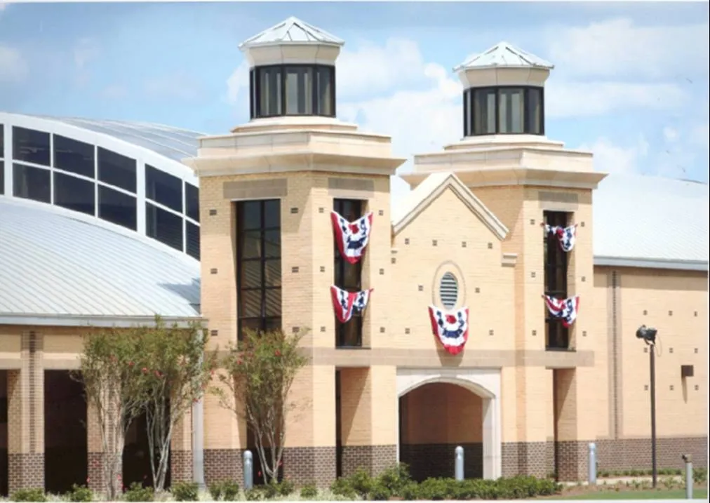
Near the route’s midpoint in White Hall, the Lowndes Interpretive Center offers a reason to stop rather than rush on to Montgomery. Its exhibits help explain local conditions and voting-rights organizing in Lowndes County, including the economic pressure faced by Black residents who challenged entrenched discrimination.
The center is near the historic site of “Tent City.” After the Voting Rights Act became law in August 1965, some white landowners evicted Black tenant farmers and their families for registering to vote or participating in voting-rights activity. Local leaders and the Student Nonviolent Coordinating Committee helped displaced families establish a temporary encampment. Residents persevered despite harassment while organizers helped them find employment and more permanent homes.
That history shows why the story does not end at the capitol steps or with a law’s passage. Leave time for the center’s exhibits and ask rangers about available programs. NPS lists the center at 7002 U.S. Highway 80 West; check the agency’s current hours and holiday closures before setting off.
5. Montgomery: Finish at the Alabama State Capitol
The final part of the route passes through Montgomery to the Alabama State Capitol on Dexter Avenue. On March 25, 1965, about 25,000 people gathered at the march’s conclusion, where Martin Luther King Jr. and others addressed the crowd. The Voting Rights Act was signed later that year, on August 6.
The route through Montgomery includes the City of St. Jude, where marchers spent their fourth and final night and a “Stars for Freedom” rally was held. Follow official trail markers through the city rather than assuming that the shortest modern navigation route follows the historic path.
For additional context, the Montgomery Interpretive Center on the Alabama State University campus is one of the trail’s NPS interpretive centers. It is a separate stop from the capitol, so allow time for both and check operating hours. The end of the drive is a good place to reflect on the many local organizers, residents and marchers whose work extended far beyond these five stops.
Planning Your Visit
Start early enough to visit at least one center while it is open. The trail is spread across multiple communities, and services or access at individual sites can change. Bring water, comfortable shoes for designated walking areas and a willingness to spend time reading or listening. NPS lists current interpretive-center hours on its official website; check those hours and the latest alerts rather than relying on older travel itineraries.