Arizona's national monuments tell stories on very different scales. One protects a volcanic landscape shaped by an eruption witnessed by local people. Another preserves a great earthen building whose purpose remains a subject of inquiry. Others invite visitors to learn about communities whose descendants maintain connections to these places today.
These eight destinations span the state, from the Verde Valley to the Navajo Nation and southern Arizona. They are ideas for several trips, not a single-day route. Check current trail conditions and visitor hours, bring water and sun protection, and treat cultural sites as places of continuing meaning rather than simply scenic backdrops.
1. Montezuma Castle: A Cliff Dwelling Above Beaver Creek

The multi-story dwelling at Montezuma Castle National Monument sits high in a limestone alcove in the Verde Valley. A short loop below the cliff gives visitors a chance to look up at the structure and consider how its builders adapted their homes to the landscape.
The name can be misleading. The National Park Service says neither the Aztec emperor Montezuma nor the Aztecs are connected to the dwelling; the name was applied by European Americans long after the community had moved on. Archeologists use the name Sinagua for people associated with this and other Verde Valley sites.

Visitors cannot enter the castle, but the park's approximately 0.3-mile loop provides views of it and nearby Castle A. Start at the visitor center, follow the signs and leave walls and artifacts untouched. Interpretive materials offer useful context that the view alone cannot provide.
2. Tuzigoot: A Hilltop Pueblo and a Valley View

Tuzigoot National Monument protects a hilltop pueblo overlooking the Verde Valley. Its rooms and pathways offer a different perspective from Montezuma Castle's cliffside setting, even though both sites are associated with the people archeologists call Sinagua, or Hisatsinom.
The National Park Service describes the pueblo as a village of roughly 110 rooms built about a thousand years ago. A short self-guided loop leads around and through the site, with views over the valley. The visitor center and museum help explain the place and the communities connected to it.

The Pueblo Trail has steep grades that may be difficult for visitors with mobility or balance concerns. The park also describes an accessible route to a Tavasci Marsh overlook. Check current conditions and entrance details before going; the park says a Tuzigoot receipt also provides entry to Montezuma Castle for seven days.
3. Walnut Canyon: Cliff Dwellings Along a Demanding Trail

East of Flagstaff, Walnut Canyon National Monument reveals homes built beneath the canyon rim. The Island Trail passes cliff dwelling rooms and offers views across the canyon to other structures, making the geology and architecture part of the same experience.
The trail is about one mile round trip, but the distance alone understates the effort. The National Park Service describes a descent of 185 vertical feet and a return climb at roughly 7,000 feet of elevation, with many stairs. Snow or ice can close the trail, and summer thunderstorms can develop quickly.

Bring water and allow time for the climb back. If the Island Trail is not suitable for your group, ask staff about the visitor center and rim opportunities instead. Do not climb, touch or lean on dwelling walls; these places are fragile and remain important to descendant communities.
4. Wupatki: An Ancestral Gathering Place in an Open Landscape

Wupatki National Monument preserves a striking group of ancestral places north of Flagstaff. The Wupatki Pueblo, behind the visitor center, includes many rooms, a community space and a ball court. Its setting in an open, colorful landscape makes the building visible from a distance, but the human story deserves a closer look.
The National Park Service describes Wupatki as a place where people gathered, traded and exchanged ideas during the 1100s. Thirteen Tribes officially recognize the monument area as culturally significant, and Hopi, Zuni, Navajo and other communities carry stories connected to it.

The self-guided pueblo trail begins near the visitor center; the park describes a paved route to the first overlook. Read the interpretation, stay on established paths and check current weather and alerts. The monument can be paired with Sunset Crater Volcano on the scenic loop, but leave enough time for each stop.
5. Sunset Crater Volcano: A Landscape of Cinders and Lava

Sunset Crater Volcano National Monument shows how quickly a landscape can change in geologic terms. The National Park Service says the eruption occurred around 1085, covering the surrounding area with volcanic material and transforming the lives of people who lived nearby.
Today visitors can see the Bonito Lava Flow and the volcanic cone from designated routes. The Lava Flow Trail includes a paved accessible upper loop, while the A'a Trail offers a short look at rough, jagged lava. The longer Lenox Crater Trail climbs a different cinder cone.

Do not hike up Sunset Crater itself: the former route was closed because foot traffic damaged the fragile slopes. Stay on designated trails, check conditions and dress for elevation. The connection with neighboring Wupatki makes this a good place to think about natural change and human history together.
6. Casa Grande Ruins: The Great House in the Sonoran Desert

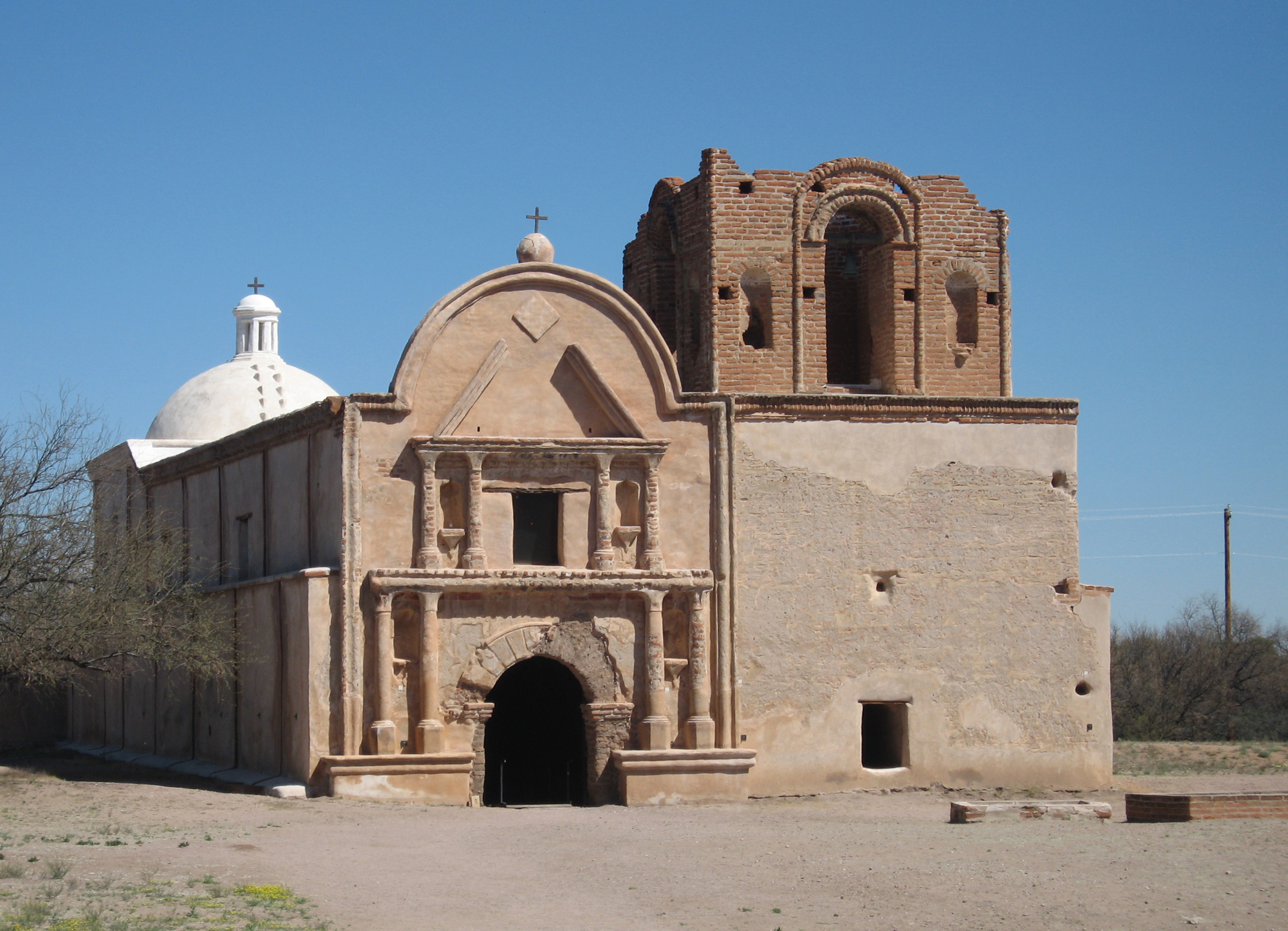
At Casa Grande Ruins National Monument in Coolidge, a protective canopy shades the Great House, also known to O'odham people as Sivan Vah'ki. This substantial earthen structure was built by ancestral Sonoran Desert people in the 1300s, within a wider community of compounds and agricultural land.
The National Park Service explains that these communities developed extensive irrigation canals and trade connections. The building's exact purpose is not known; interpretations and O'odham traditions give visitors different ways to understand a place that remains culturally significant to descendants today.

A short self-guided walk follows interpretive signs around the site, and the visitor center offers exhibits and a film. The Great House interior is closed to ordinary public entry. Bring water, check operating hours and approach the site with the respect due to a living cultural connection.
7. Tonto: A Cliff Dwelling Above the Basin

At Tonto National Monument, a trail climbs through the Sonoran Desert to a cliff dwelling overlooking the Tonto Basin. The combination of architecture, desert plants and a broad valley view makes the setting memorable, but the route requires more effort than the distance might suggest.
The Lower Cliff Dwelling trail is about one mile round trip, with a steep paved climb. The National Park Service adjusts the latest permitted start time seasonally, and heat, lightning or other hazards can close the trail. Check in at the visitor center, carry water and do not start a hike your group is not prepared to finish.

The Upper Cliff Dwelling is a longer outing available only on a guided tour with a reservation. Tour schedules vary, so check the park's current guidance rather than assuming a place will be available. Leave cultural materials in place and follow staff instructions inside the dwellings.
8. Canyon de Chelly: Overlooks Above a Living Homeland

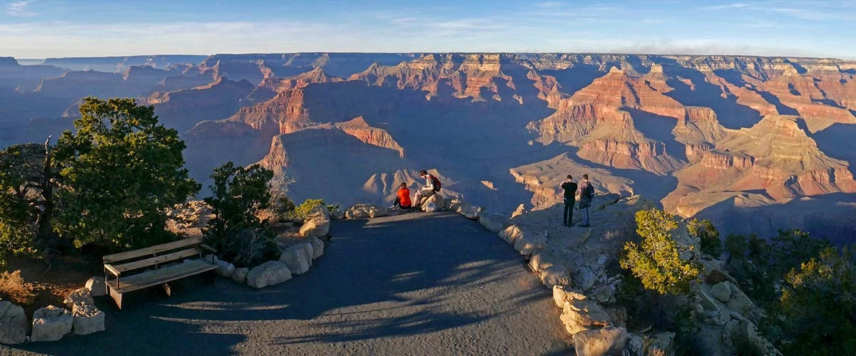
Canyon de Chelly National Monument is entirely on Navajo tribal lands, and families live in the canyon. The sandstone walls and overlooks are extraordinary, but this is also a living homeland with continuing cultural and spiritual importance.
Visitors can drive the paved North and South Rim roads to overlooks on their own. Most travel into the canyon requires an authorized guide or a ranger; check the current National Park Service and Navajo Nation guidance before arranging a trip. The park's pages have differed about the status of the White House Trail, so confirm directly before relying on it.

Begin at the welcome center and use the park's recommended paved approach through Chinle. The National Park Service cautions that GPS and cell service can be unreliable and advises against the unmaintained eastern approach on Route 7. Respect residents' privacy, posted rules and any restrictions on access.
Before You Go
Check official park alerts, trail and road conditions, fees, reservations and seasonal hours before traveling. Distances are long, summer heat can be extreme and higher-elevation sites can see winter ice. Carry water, leave rocks and artifacts where they are, and stay on permitted routes.