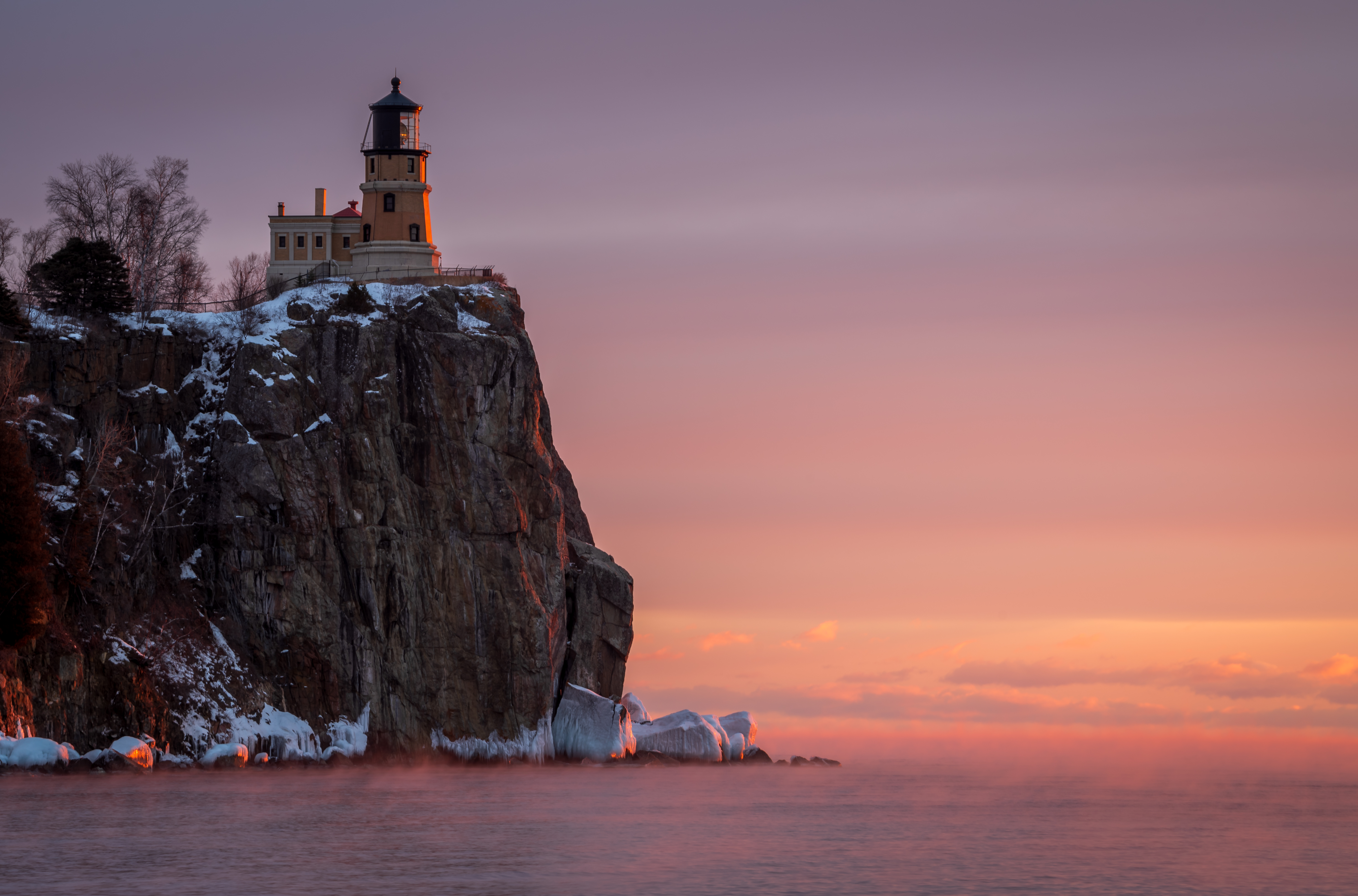
On Minnesota's North Shore, a river can disappear into the woods beside Highway 61 and reappear a short walk later as a waterfall. Some arrive in a thunderous drop. Others tumble through narrow gorges or over a series of ledges, offering a different view at each bend in the trail.
These eight stops follow the shore from Gooseberry Falls toward the Canadian border. They're not ranked, and there is no need to squeeze them all into one day. Choose a few that fit your schedule and walking ability, check current trail conditions and leave time to enjoy the lake between stops.
1. Gooseberry Falls: A North Shore Classic With Several Views

At Gooseberry Falls State Park, the river delivers more than one memorable moment. The upper, middle and lower falls give visitors a chance to see the same waterway change character as it works through the rocky landscape toward Lake Superior.
The Minnesota Department of Natural Resources describes a short accessible route to views of the Upper and Middle Falls. The Falls Loop includes stairs and crosses the river, so look at the park map before deciding which combination of views suits your group. The park's visitor center and shoreline provide other ways to spend time here.

Spring runoff can make the falls especially energetic, while autumn brings a different forest backdrop. Water levels and trail surfaces change with the weather; admire the river from designated paths and overlooks rather than stepping onto wet rock.
2. Fifth Falls: A Quieter Walk Up the Gooseberry River

If the main Gooseberry overlooks leave you wanting a longer walk, the same park has another destination upstream. Fifth Falls makes a good choice for visitors who enjoy the journey through the woods as much as the moment at the waterfall.
The DNR describes a roughly two-mile Fifth Falls loop with hilly stretches, gravel and boardwalks. It is a different outing from the short route to the main falls, so allow more time and check trail conditions at the visitor center. The name marks this as part of the Gooseberry River system rather than a separate park.

Listen for the river through the trees and notice the rock formations along the way. After wet weather or in winter, footing can be challenging. A shorter look at the more accessible main falls is a perfectly good alternative when conditions or energy call for it.
3. High Falls of the Baptism River: A Forest Hike at Tettegouche

Tettegouche State Park's High Falls rewards visitors who are ready to spend more time on the trail. The Baptism River drops through a wooded setting inland from Lake Superior, making this a waterfall trip and a North Woods hike in one.
From the visitor center, the DNR's suggested route is about three miles round trip. It includes uneven surfaces, boardwalks and stairs; an additional stairway leads toward the base of the falls. The park also has other waterfalls, including Two Step Falls, along the river corridor.

Bring water and sturdy footwear and check the park's current alerts before setting out. It's easy to underestimate the time needed when a walk includes a steady climb and stops for photos. If the stairs are uncomfortable for anyone in your party, plan around the available overlooks instead.
4. Caribou Falls: A Wayside With a Wooded River Trail
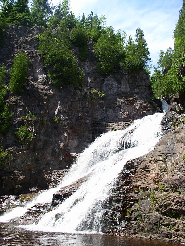
Caribou Falls State Wayside is a reminder that a small roadside stop can lead to a much bigger view. Its trail follows the Caribou River toward a waterfall that the DNR describes as approximately 35 feet high, with glimpses of the gorge and Lake Superior along the way.
The state describes a three-quarter-mile trail within the wayside. Treat that as one-way trail information, not the length of your entire visit: you'll also need to walk back. The route gives access to the longer Superior Hiking Trail, but visitors can keep the waterfall as their primary destination.

There are practical limits to this stop. The DNR says the wayside is seasonal, generally May through November, and is not plowed or accessible in winter. Overnight parking is not allowed. Check the current status before you drive and use extra care on the approach to the water.
5. Temperance River Lower Falls: Water in a Narrow Gorge

At Temperance River State Park, the attraction is as much the shape of the gorge as the falling water itself. The river cuts through hard volcanic rock on its way to Lake Superior, creating deep channels, potholes and a series of falls.
The Lower Falls lies just upstream of the river mouth. The DNR's park tour describes an overlook with views of the lower falls and lake, as well as a bridge above the gorge. From the trails and established viewpoints, you can see how the water has worked through the rock without needing to approach the edge.

Consider pairing the waterfall with a shoreline stop or a longer park walk if time permits. Trail surfaces and river levels vary, so check alerts, keep children close near steep edges and stay behind barriers. Fast water and slippery stone make the gorge a place to look, not scramble.
6. The Cascades: Five Small Waterfalls on One River

Cascade River State Park takes its name from the water tumbling down toward Lake Superior. Rather than one isolated plunge, the Cascades are a series of five smaller waterfalls, with different angles appearing as the trail follows the river.
The park's published map recommends the half-mile Cascade River Lower Loop to see the Cascades and Cascade Falls. A walking bridge provides another perspective upstream and downstream. The route is a useful short stop, though rocky and uneven ground still calls for sturdy shoes and attention.

Travelers with more time can explore the Lake Superior shoreline or consider the longer Lookout Mountain route. Keep the waterfall stop flexible after rain or snow: North Shore rivers can rise quickly, and the park advises against swimming in these unpredictable waters.
7. Devil's Kettle: A Waterfall With a Famous Question

In Judge C.R. Magney State Park, the Brule River divides at an outcrop. One side plunges into a pool, while the other pours into the pothole known as Devil's Kettle. It is an arresting sight, and for years it inspired stories about where the water might go.
Minnesota DNR hydrologists measured the river above and below the falls in 2016. The similar readings supported the explanation that the water returns to the river downstream, rather than disappearing into a separate route to Lake Superior. The sight remains fascinating even with that evidence in hand.

The walk to the falls involves more than a roadside glance, with a substantial climb and stairs on the route. Check the park's current map and alerts, bring water and allow time to return. Observe from the designated overlook, and never throw objects into the water.
8. Pigeon River High Falls: A Border Country Finale

At Grand Portage State Park, the Pigeon River forms part of the border between Minnesota and Canada and drops over the state's highest waterfall. The National Park Service explains that these falls and the surrounding rapids helped make the historic Grand Portage route important to canoe travelers who needed to bypass this stretch of river.
The park's High Falls Trail is about one mile round trip on a paved route and boardwalk. The National Park Service lists it as wheelchair accessible in summer; confirm present conditions and which viewpoints meet your needs before leaving. A longer and more challenging route leads to Middle Falls.

This is a fitting place to slow down and consider the landscape as more than a scenic backdrop. Grand Portage State Park is managed by Minnesota's DNR; nearby Grand Portage National Monument shares the area's Indigenous and fur-trade history. Check current visitor information for each site separately.
Before You Go
Check the Minnesota DNR's current park alerts, permit requirements, maps and weather before traveling. Trails may have stairs, steep grades, mud or ice, and conditions can change quickly. Respect closures, keep clear of cliff edges and moving water, and plan driving time between stops rather than treating the whole shore as one short hike.