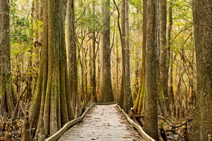
Just southeast of Columbia, Congaree National Park protects an extraordinary old-growth bottomland forest. The landscape is shaped by rivers that periodically spread water across the floodplain, carrying nutrients into a forest of towering hardwoods, cypress and tupelo. An elevated boardwalk gives first-time visitors an inviting introduction, while longer trails and a marked canoe route reveal more of the park.
Congaree is not a static landscape. Flooding, storms and fallen trees can change access quickly. Check the National Park Service's current alerts before leaving and choose an outing that fits the day's conditions as well as your experience.
1. Start at the Harry Hampton Visitor Center
The visitor center is a useful first stop for a park map, a self-guided boardwalk brochure and advice about current conditions. Ask about water levels, trail closures and ranger programs before setting off. The numbered stops along the boardwalk correspond to the brochure and explain natural and cultural features you might otherwise pass without noticing.
Check current center hours separately from access to park grounds. The park's 2026 compendium lists a regular 9 a.m. to 5 p.m. schedule with holiday exceptions, but temporary changes are possible. Bring water, insect protection and suitable footwear. Cell service can be limited, so save a map before arriving.
2. Follow the Boardwalk Trail into the forest
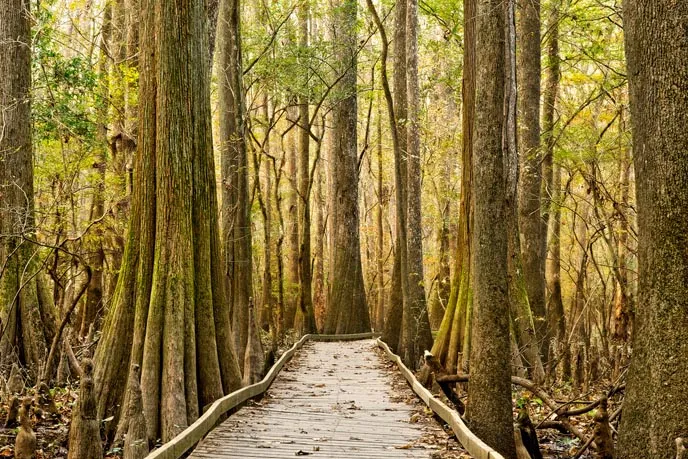
The approximately 2.6-mile Boardwalk Trail begins at the visitor center and leads from higher ground into old-growth bottomland forest. The NPS describes the route as wheelchair and stroller accessible, with benches along the way. Its elevated and lower sections allow visitors to see the floodplain at different heights.
Look for the broad bases of bald cypress and tupelo in wetter areas, and for loblolly pine, oak, maple and holly along the route. Cypress knees rise from the ground around some trees; their varied shapes are part of the forest's character. Take your time and use the numbered guide to understand what you are seeing.
Some lower boardwalk sections can flood. The park reported the boardwalk open in a May 2026 construction update, but that is not a guarantee for a later visit. Check live alerts and ask about the particular route before you go, especially after heavy rain.
3. Choose a longer walk with the weather in mind
For a different view, the NPS lists the Bluff Trail as a roughly 1.8-mile loop through younger pine forest. The moderate Weston Lake Trail is approximately 4.5 miles and follows part of Cedar Creek and a cypress-tupelo slough. Distances are approximate and assume that the trails are passable.
Most ground trails are subject to periodic flooding, and downed trees or storm debris can make navigation difficult. Longer wilderness routes require greater preparation and can be difficult to follow. Carry water, a map and offline navigation, tell someone your plans, and turn around when conditions exceed your comfort or experience. The trail page may not be updated every time flooding occurs; consult park alerts as well.
4. Experience Cedar Creek from the water
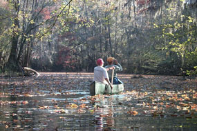
A marked canoe trail offers a quieter perspective on Cedar Creek. The park advises visitors to bring their own canoe or arrange rentals outside the park, along with personal flotation devices. Paddling is a separate commitment from a boardwalk walk: water levels, weather, obstacles and a group's paddling skills all matter.
Review the NPS canoe trail conditions and access points before planning a trip. Do not assume that a marked route is clear after storms; strainers and downed trees can create serious hazards. Wear properly fitted flotation devices and choose a shorter or different activity if the current conditions do not suit your group.
5. Look closely and protect the floodplain
Congaree rewards patience. Watch the water for turtles and wading birds, listen for forest birds, and notice how the vegetation changes with elevation. Wildlife sightings vary, and animals should always have room to move. Keep to open routes, do not feed wildlife and leave plants and natural features where they are.
Mosquitoes and other biting insects are part of a wetland environment, particularly in warmer months. Use appropriate repellent and clothing, carry drinking water and prepare for heat. The NPS explains that the area is a floodplain, not simply a permanently flooded swamp; periodic high water is an important ecological process even when it limits access for visitors.
6. Build a flexible first-day itinerary
With a couple of hours, begin at the visitor center and spend unhurried time on the boardwalk. With more time and favorable conditions, add an open trail suited to your group or plan a properly equipped paddle. Camping is a separate overnight option requiring the appropriate reservation or permit; check current availability and flood closures.
The park is at 100 National Park Road, Hopkins, South Carolina. Call 803-776-4396 for visitor information, and check weather and alerts immediately before the drive. A flexible plan lets the forest set the pace while keeping safety and conservation in view.