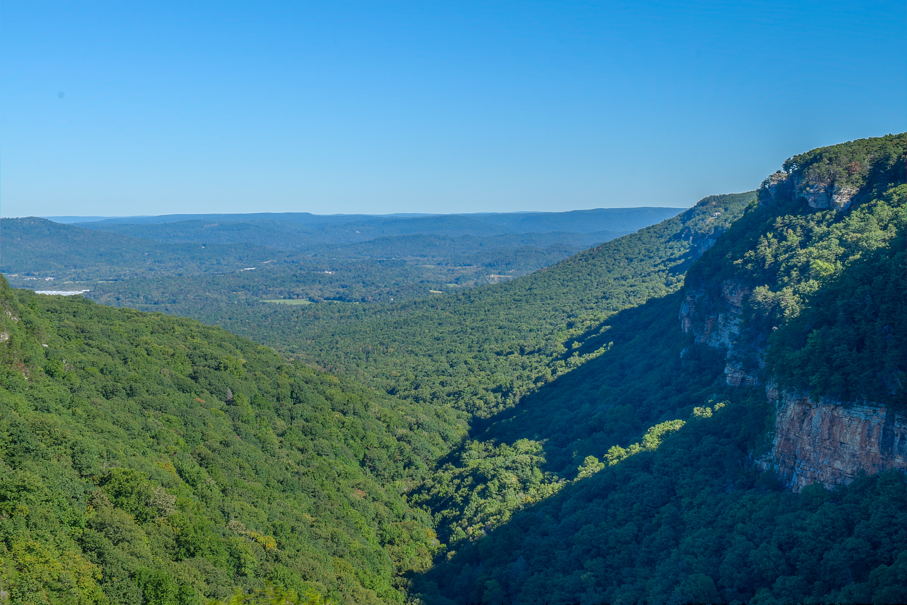
Georgia's waterfalls don't all reward the same kind of outing. Some can be enjoyed from an overlook after a short walk. Others require a long staircase into a canyon, with the climb back up waiting at the end. One famous pair of falls tumbles from two separate creeks into a shared stream.
These seven destinations include forest hikes and state park stops across northern and central Georgia. They are ideas for separate visits rather than one quick road trip. Check current access, weather and fees before leaving, and choose a route that fits your group.
1. Amicalola Falls: A Mountain Cascade With More Than One View

Amicalola Falls tumbles down a forested mountainside at Amicalola Falls State Park and Lodge near Dawsonville. Georgia State Parks describes the cascade as 729 feet tall, but the impressive number is only part of the appeal: different viewpoints reveal different pieces of the waterfall and the valley around it.
There are several ways to experience the park. A hard-surfaced trail leads to a waterfall view, while the longer loop and staircases require much more effort. Ask staff about current route conditions and accessible options, and remember that a paved surface does not automatically mean every section is level.

The park is also associated with the approach route to the Appalachian Trail. You don't have to plan a long-distance hike to appreciate the setting, though: give yourself time to visit an overlook, read about the area and enjoy the mountain scenery. A state park parking fee applies.
2. Anna Ruby Falls: Two Creeks, One Forest Walk

Near Helen, Curtis Creek and York Creek descend side by side at Anna Ruby Falls before joining to form Smith Creek. The twin falls make a memorable destination, and the creekside walk to the observation decks adds its own sights and sounds along the way.
The visitor center operator describes the main trail as paved but steep, about 0.4 mile one way. Its accessibility guidance says the main falls trail is not suitable for wheelchairs, scooters or other mobility devices; ask staff about the separate Lion's Eye Trail and the most current conditions if you need an accessible option.

Anna Ruby Falls is operated separately from nearby Unicoi State Park and has its own admission fee. Check current hours and payment details before visiting. Swimming and entering the creek are prohibited here, so enjoy the falls from designated trails and viewing decks.
3. High Falls: Water and History South of Atlanta

High Falls State Park near Jackson is named for the cascades of the Towaliga River. It offers a chance to combine waterfall watching with a look at an area that once supported mills and other industry.
The park's Historic Trail passes structures connected to that past and includes a falls overlook. Georgia State Parks describes this crushed-gravel route as accessible, while the longer Falls View Trail is rated strenuous and follows rougher terrain beside the river. Check the trail map and ask staff which option best suits your party.

Beyond the waterfall, the park has a lake, camping and opportunities for fishing and paddling. Check alerts before planning around the lake or a particular facility, and allow time for a picnic or a longer walk. A ParkPass is required for vehicles.
4. Cherokee Falls: A Cloudland Canyon Descent

At Cloudland Canyon State Park in northwest Georgia, the Waterfalls Trail descends from the rim into a landscape of sandstone and shale. Cherokee Falls is the first of the two named waterfalls along this route, roughly half a mile from the main trailhead according to the park.
The distance is only part of the story. The trail is steep and includes metal stairs, and every step down needs to be climbed again. Wear shoes with good traction, carry water and allow time for the return. Dogs may have difficulty on grated stairs; check the park's current guidance before taking one along.
Water flow changes through the year and with recent weather. Stay on the designated trail and viewing areas, and do not swim or climb around the falls. If a steep descent isn't right for your group, the park also has rim overlooks where you can appreciate the canyon.
5. Hemlock Falls: Farther Into Cloudland Canyon
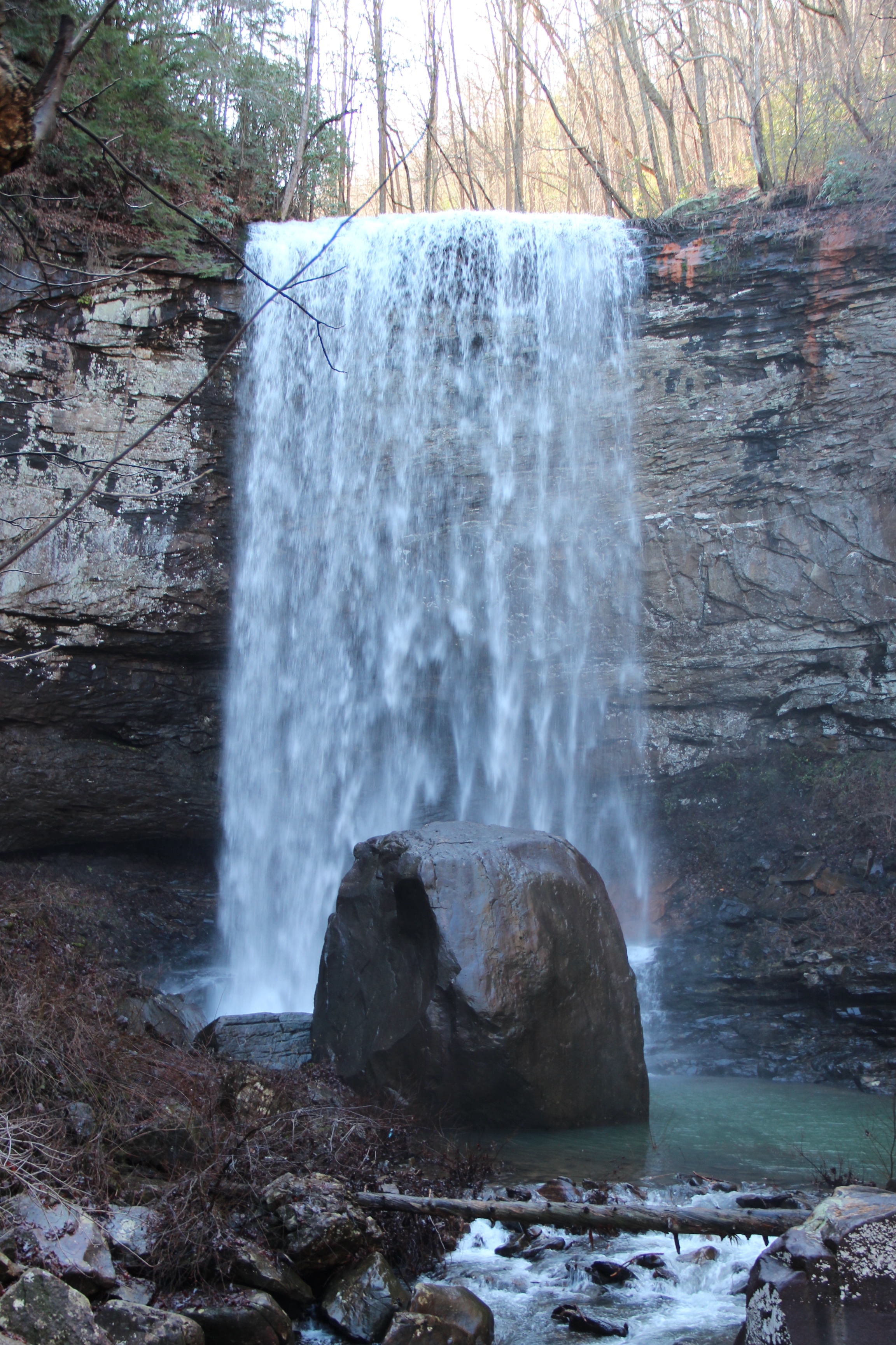
Hemlock Falls is farther down the same Cloudland Canyon Waterfalls Trail, giving hikers who are prepared for a tougher outing another reason to continue past Cherokee Falls. The rock walls and forest make the descent feel distinct from the broad views at the canyon rim.
Georgia State Parks describes approximately 600 stair steps one way to Hemlock Falls and rates the route strenuous. Turn around whenever you need to: reaching one viewpoint is not a commitment to finish the entire trail. Conditions can be slick after rain or in cold weather.

Check the park's current trail information before your trip and consider the needs of everyone in your party. Waterfall flow varies, and swimming is not permitted on this trail. Keep a respectful distance from the water and fragile vegetation, and save enough energy for the climb out.
6. Hurricane Falls: A View Into Tallulah Gorge

Hurricane Falls is one of several waterfalls along the Tallulah River in Tallulah Gorge State Park. The gorge's depth and rocky walls make this a place where the whole landscape competes for your attention, not just the water below.
Rim trails and overlooks offer ways to see the gorge from above. A staircase leads down toward a suspension bridge, but it is a demanding route with many steps; check the park's trail map and current closures before deciding how far to go. Pets are not allowed on the Hurricane Falls staircase to the bridge.

Hiking onto the gorge floor is a separate, strenuous activity requiring a limited permit and a safety briefing. Weather and scheduled water releases can restrict access, and the park may close stairs during releases. Call ahead and never assume that a permit or a bridge route guarantees access to the riverbed.
7. DeSoto Falls: Two Waterfalls in the National Forest

In the Chattahoochee-Oconee National Forest, the DeSoto Falls Recreation Area provides access to upper and lower falls along a forest trail. The creek, rhododendron and woodland make the walk itself a central part of the visit.
Recreation.gov describes the lower falls as roughly a quarter mile from the trail access bridge and the upper falls as about three-quarters of a mile away. Those are one-way distances; check the current map and conditions, and allow time to return. The trail includes elevation changes, so take your time on wet or uneven ground.

The recreation area also has camping and day-use facilities, but published sources differ on seasonal operations. Check with the managing agency for current access, parking fees and camping availability before traveling. Fast water and slippery rocks are hazardous: stay on the trail and do not climb or swim near the falls.
Before You Go
Rain and releases can change water levels, and wet rocks can be slippery even on a sunny day. Check park alerts, forecasts, permit requirements and hours shortly before traveling. Stay behind barriers, supervise children, never jump from waterfalls and leave natural features undisturbed. If a trail or water crossing feels unsafe, turn back.