In Illinois, a memorable outdoor trip might lead to a sandstone canyon, a river bluff or a cave looking out over the Ohio River. The state's landscapes change considerably from the rolling northwest to the wooded Shawnee Hills in the south, and the best way to appreciate them is to stop long enough to explore.
These eight places are spread across the state, so think of them as ideas for several trips rather than a single weekend itinerary. Check park alerts and seasonal closures before leaving, choose trails that suit your group, and give yourself time to enjoy the places between the stops.
1. Starved Rock State Park: Sandstone Canyons Along the Illinois River
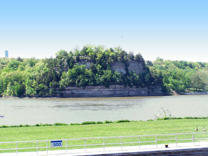
Starved Rock is a natural starting point for an Illinois canyon trip. The park's sandstone walls, river overlooks and wooded trails offer several ways to explore, while waterfalls may appear in the canyons after rain or snowmelt. In dry weather, a waterfall that looked dramatic in a photograph can be only a trickle.
Begin at the visitor center and ask which routes are open. Illinois is improving the park's trails, stairs and bridges through an ongoing construction project, with access changing as work moves through the park. The state's project page lists current closures and suggested alternatives.

The park's history is much older than its trails. Illinois DNR notes that Indigenous people lived across the river at the Grand Village of the Kaskaskia, also known as La Vantum. Let the exhibits and local interpretation add context to the scenery, and remain on marked paths around the bluffs.
2. Matthiessen State Park: A Walk Through the Dells

Not far from Starved Rock, Matthiessen offers a different look at the region's sandstone landscape. Its main canyon includes the Upper and Lower Dells, with Cascade Falls marking the drop between them. Mossy walls and water-shaped rock give the walk a sheltered, intimate feel.
The park began as a privately owned area developed by industrialist Frederick William Matthiessen. After his death, it became a public park; the state later named it for him. Trails, bridges and stairs still shape how visitors experience the canyon today.

Check the park's current notices before choosing a route. The Lake Falls bridge and trail were listed as closed with a detour when this guide was prepared, and hunting periods can bring additional closures. Stay on marked trails and do not swim in the canyon creeks or waterfalls.
3. Garden of the Gods: Rock Formations Above the Shawnee Hills

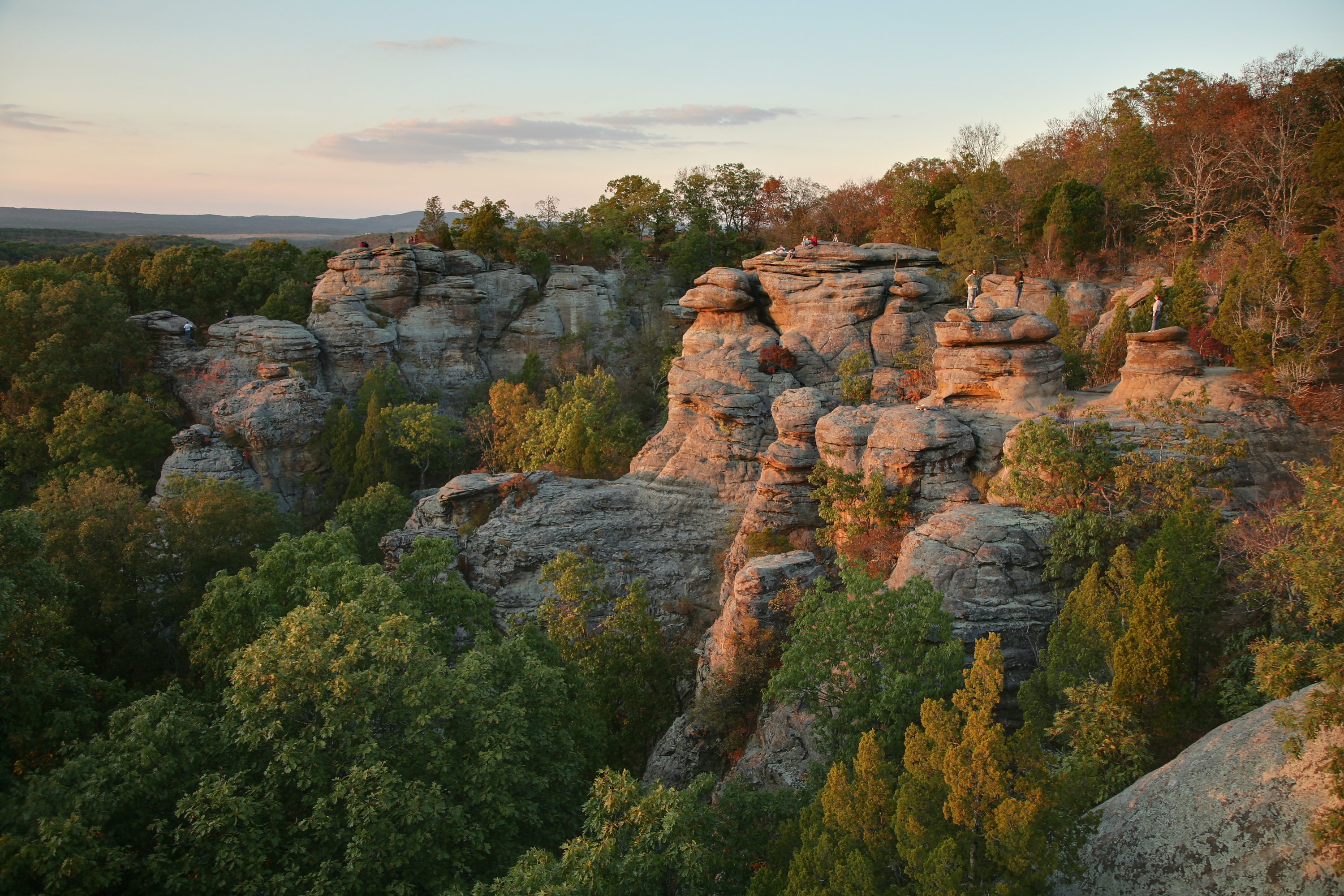
Southern Illinois has its own Garden of the Gods, a Shawnee National Forest recreation area where sandstone formations rise above a broad wooded landscape. It is easy to spend a long time looking at the rock shapes and then turning around for another view across the hills.
The Forest Service describes the Observation Trail as a quarter-mile interpretive walk with short steep grades and a few steps. From the trail, formations have names such as Camel Rock and Devil's Smokestack. A short distance on the map does not make the cliff edges forgiving, however, so supervise children closely and keep well back from drop-offs.
Consider the walk one part of a broader Shawnee Hills visit rather than trying to see every attraction in an afternoon. Check Forest Service notices and carry water, especially in warm weather. Conditions underfoot can change after rain.
4. Giant City State Park: A Walk Between Sandstone Walls

At Giant City State Park near Carbondale, sandstone bluffs form passageways known as the Giant City Streets. The scale gives the popular Giant City Nature Trail its name: visitors walk through a landscape that can feel like a stone neighborhood built for much larger inhabitants.
The surrounding woods contribute as much to the experience as the rock. Ferns, mosses, trees and seasonal wildflowers soften the edges of the massive formations, and the park offers other trails for visitors who want a longer outing.

Pick up a map and match the trail to your group's abilities; steps, uneven ground and wet rock can slow a walk. The park also has a historic lodge and other facilities, but hours vary by season, so confirm details if a meal or overnight stay is part of the plan.
5. Ferne Clyffe State Park: A Shelter Bluff and a Seasonal Waterfall

Ferne Clyffe, in the Shawnee Hills, pairs woodland trails with rock formations and an intermittent waterfall. Illinois DNR identifies two of its best-known sights as Hawks' Cave, a long shelter bluff, and the waterfall along Big Rocky Hollow Trail.
The waterfall depends on water conditions, so the rock amphitheater itself may be the main attraction during dry spells. That makes this an especially useful stop for travelers willing to enjoy the landscape as they find it, whether water is pouring over the bluff or not.
Spring wildflowers and fall color add different reasons to return. Check the park's trail information, wear shoes suited to uneven ground and remain on designated routes. Climbers should review site-specific rules rather than assuming the same restrictions apply everywhere in the park.
6. Cave-in-Rock State Park: A Cave Beside the Ohio River
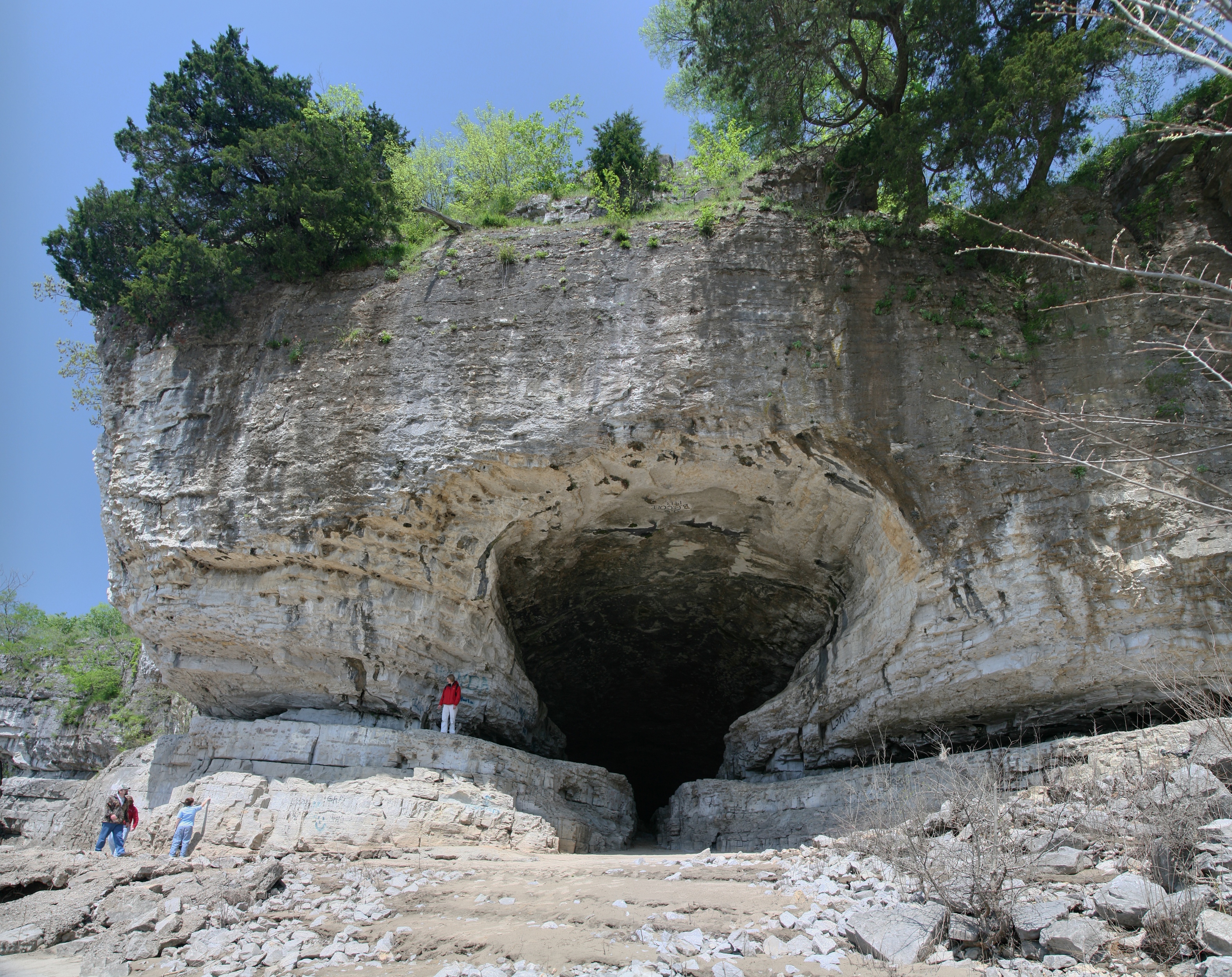
Cave-in-Rock's limestone opening faces the Ohio River in southeastern Illinois. The state describes the cave as 55 feet wide, carved by water over thousands of years. Looking out from the entrance gives visitors a sense of why the feature became such a visible landmark for people traveling the river.
The cave has accumulated plenty of stories about river outlaws. The park's history page also distinguishes popular lore from documented connections, a useful reminder to enjoy a dramatic tale without treating every version as settled fact.

The approach has roughly 55 to 60 stairs, according to the park's accessibility information, and the riverfront is uneven and rocky. Check conditions before visiting, especially around high water, and consider the park's other river views, picnic areas and moderate trails if the cave approach is not suitable.
7. Mississippi Palisades State Park: Bluffs Above a Great River

Near Savanna in northwestern Illinois, Mississippi Palisades offers high bluff views over the Mississippi River. The setting is especially rewarding when you have time to notice both the broad river landscape and the smaller details of the woodland around you.
The park has a network of trails with different levels of difficulty. Illinois DNR describes the northern trails as generally wider and less strenuous than the southern routes, which run close to the bluffs and can be hazardous when wet. Several developed overlooks can be reached by shorter walks.

Access changes: the state's current closures page listed Lookout Point as closed while other named overlooks remained open. Confirm the latest notice and seasonal hunting closures before driving, and avoid approaching bluff edges for a photo.
8. Apple River Canyon State Park: A River Through the Driftless Hills

Apple River Canyon brings the road trip into the hilly northwest corner of Illinois, near the Wisconsin border. Limestone bluffs, wooded ravines and the winding river create a landscape quite different from the sandstone canyons farther south and east.
The park lies in the Driftless Area, a region whose rugged terrain was not smoothed by the continental ice sheets that affected much of the surrounding Midwest. Water carved the canyon through layers of rock, and today the state park provides a way to experience a small part of that larger landscape.

Choose from the park's marked trails or plan a picnic beside the river. Illinois DNR lists the Primrose Trail as accessible, though travelers should check present surfaces and facilities for their particular needs. Some nearby protected areas are not open to the public; follow signs and use the state park's designated access points.
Before You Go
These destinations are hours apart, and opening conditions can change with construction, flooding, hunting seasons and weather. Consult the official park or forest page for each stop before leaving. Carry water, stay on marked trails, respect closures and keep away from cliff edges and moving water.