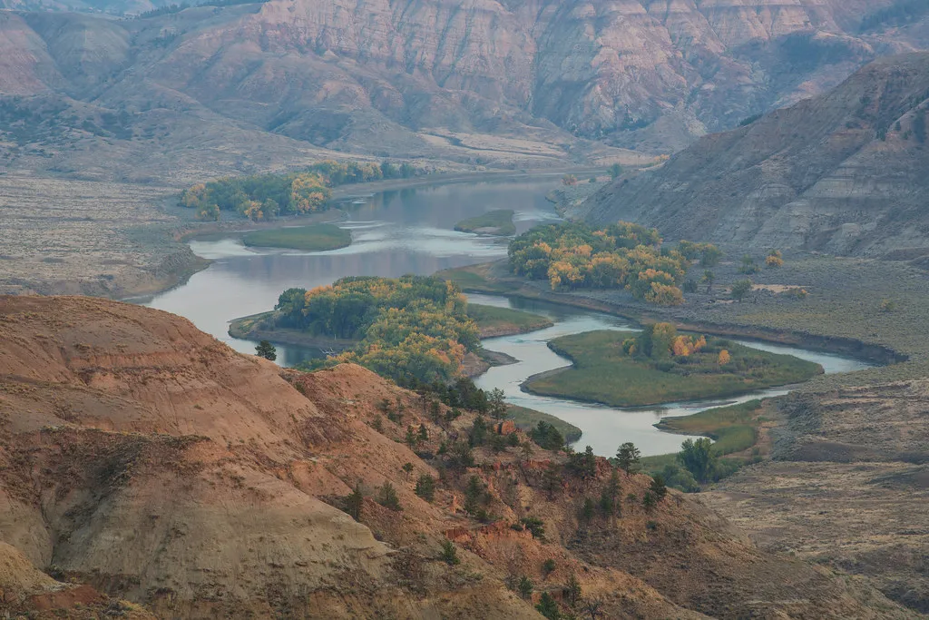
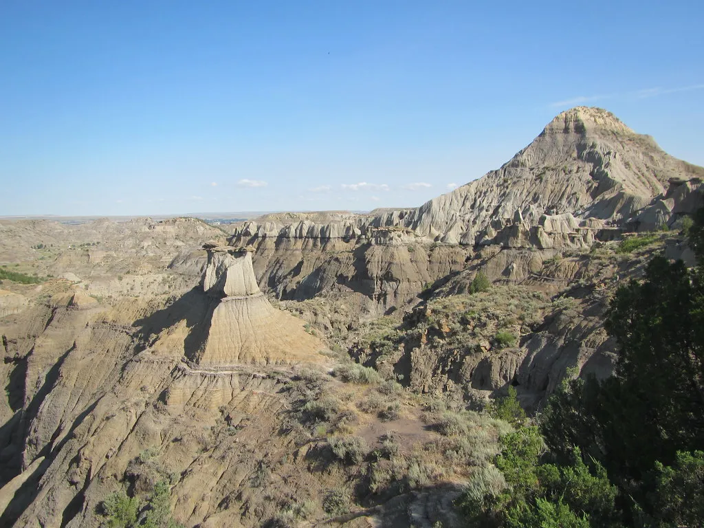
South of Glendive, the ground folds into a maze of ridges, gullies and pale sculpted formations. Makoshika State Park shows a side of Montana very different from the mountain lakes farther west—and its rocks preserve evidence of an even older world.
Montana Fish, Wildlife & Parks calls Makoshika the state’s largest state park. Its badlands are part of the Hell Creek Formation, where dinosaur fossils have been found. Here are five ways to explore the park thoughtfully, with time for the visitor center, the landscape and the practical realities of badlands travel.
1. Begin with the visitor center’s fossil exhibits
The visitor center near the park entrance offers a helpful introduction to the geology and paleontology behind the scenery. The state says its exhibits include fossils of Triceratops and Tyrannosaurus rex along with other examples from the area. Ask staff for a map and current trail conditions before heading farther into the park.
Makoshika’s rocks belong to the late Cretaceous Hell Creek Formation. More than ten dinosaur species have been discovered in the park, according to Montana FWP. The displays help connect the fossils to the landscape outside and to the careful scientific work involved in studying them.
Visitor-center hours change seasonally and holiday closures apply. Check the park’s current schedule before making the exhibits your first stop, particularly in winter. The park itself and the center may have different hours.
2. Take a scenic drive through the badlands
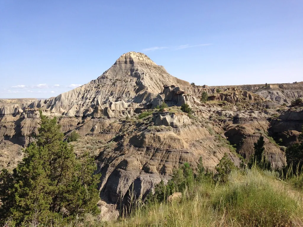
Makoshika’s roads provide views of eroded slopes, layered formations and scattered pine and juniper. Drive slowly and use designated pullouts so other visitors can pass safely. A short stop at an established viewpoint can reveal how water and weather have shaped the softer rock into ridges and channels.
The scenery can change dramatically with light. Morning or late afternoon may bring shadows across the slopes, while a cloudy day can soften their colors. Check the forecast and road conditions first: rain and snow can make unpaved surfaces slippery or difficult to travel.
Stay on authorized roads and respect signs and closures. Do not drive or climb across fragile formations to reach a photograph. What looks durable from a distance may be soft, steep or unstable underfoot.
3. Choose a trail that fits your group
The park lists eleven designated hiking trails. Ask for a current trail map, check the route length and difficulty, and start with a walk that leaves enough time for a relaxed return. A short climb can feel more strenuous in heat or after rain, especially on exposed badlands terrain.
Montana FWP describes the Bluebird Trail as a moderate one-mile out-and-back walk with a short steep section. It can become slippery when wet. Use this as a planning reference, not a guarantee of current conditions; speak to park staff and turn around if the surface or weather is beyond your comfort level.
Bring drinking water, sun protection and shoes with good traction. Watch for drop-offs and keep children close. Stay on designated routes to protect the formations and avoid damaging paleontological or cultural resources.
4. Leave fossils and artifacts where you find them
The possibility of ancient remains is exciting, but a fossil’s scientific value depends partly on its exact location and the surrounding rock. The park explicitly prohibits digging, collecting or removing fossils and artifacts, and asks visitors not to bring metal detectors.
If you see something that looks interesting, leave it in place and tell park staff where you saw it. A photograph can help you remember the discovery without removing it from its context. The same principle applies to plants, rocks and historic objects throughout the park.
The name Makoshika is a variant spelling of a Lakota phrase meaning “bad land” or “bad earth,” according to the state. Take a moment to consider the human history of the area alongside its fossil record: these landscapes have long been known and used by Indigenous peoples.
5. Plan an overnight stay or a return visit
The state lists camping in Makoshika, along with picnic areas and seasonal programs. Check campsite details, reservation requirements and current water availability before arriving. A campsite can give you time to see the landscape in changing light without rushing, but it also requires preparation for exposed weather and temperature swings.
Before you leave, review the official Makoshika page for current hours, fees, alerts and road conditions. The listed park address is 1301 Snyder Avenue in Glendive. Pack out trash, respect other visitors and leave enough daylight for the drive back.
Whether you come for dinosaurs, a short trail or a wide view across the badlands, the best visit combines curiosity with care. The formations and fossils are the reason the park is special—and the reason to tread lightly.