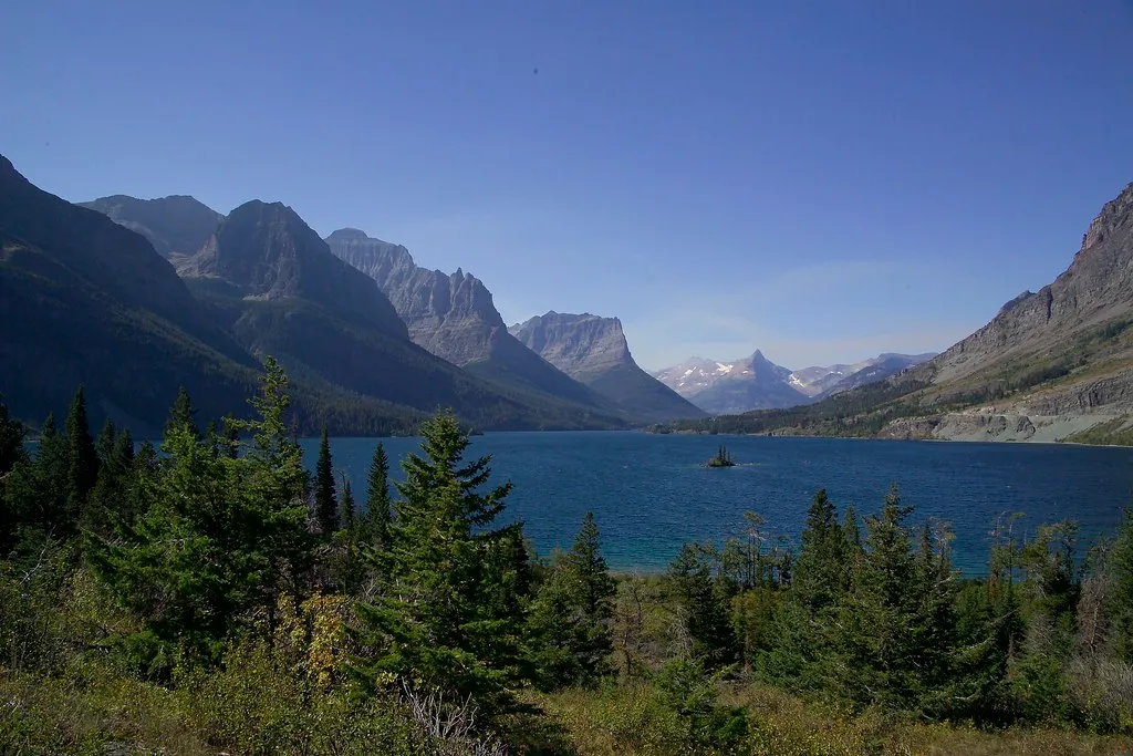
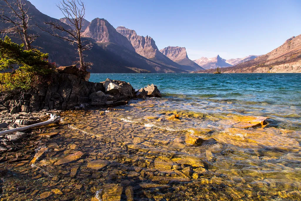
On Glacier National Park’s eastern side, St. Mary Lake stretches beneath high peaks, its long blue surface broken by a tiny island and framed by a landscape that changes with light and weather. This valley is more than the eastern end of a famous drive: it offers short walks, waterfall trails and opportunities to learn about the Indigenous peoples connected to these lands.
Road and trail access is seasonal, and conditions can change quickly. Use these seven ideas to plan a visit around what is actually open rather than trying to squeeze every stop into one day.
1. Begin at St. Mary Visitor Center
The St. Mary Visitor Center sits near the park’s eastern entrance and the community of St. Mary, on U.S. Highway 89. When open, it offers maps, trip-planning information and exhibits on American Indian tribes and their ties to the lands now within Glacier National Park. The center generally operates from late May into early October; check current hours and construction notices before your visit.
Begin by asking about road openings, parking, bear activity and the trails you intend to hike. The area is near the Blackfeet Indian Reservation, and its cultural history extends long before the park was established. Give the exhibits time alongside the scenery.
2. Take in Wild Goose Island Overlook
From the overlook along Going-to-the-Sun Road, tiny Wild Goose Island provides a focal point in the broad lake beneath the mountains. The view is worth a pause in changing weather as well as sunshine: clouds and wind can alter the appearance of the water within minutes.
Use the designated parking area and allow other visitors room at the viewpoint. Never stop in a traffic lane or step into the roadway for a picture. The overlook depends on road access, so check the park’s current road status before making it a must-see stop.
3. Discover Sunrift Gorge
Sunrift Gorge offers a short walk from a pullout along the road. The park’s hiking guide lists the gorge as 200 feet one way with about 40 feet of elevation gain. Although brief, the path can still be affected by weather and slippery conditions.
Look for the way water has cut through the rock rather than rushing back to the car. Remain on established surfaces and behind barriers; wet rocks near moving water are hazardous. The same pullout can be a starting point for longer walks, but confirm which trails are open before setting out.
4. Walk toward Baring Falls
The National Park Service lists Baring Falls as 0.3 mile one way from Sunrift Gorge, with a descent of about 250 feet. Remember that the return involves regaining that elevation. The distance is modest, but sturdy shoes, drinking water and enough time to climb back make the outing more comfortable.
Trail surfaces, water levels and wildlife closures vary. Stay back from stream edges and do not try to cross rushing water for a different angle. If the trail is closed or your group is not comfortable with the descent, choose another safe stop rather than treating the waterfall as essential.
5. Give St. Mary Falls its own time
St. Mary Falls can be reached by different routes. From the St. Mary Falls trailhead, the park lists 1.2 miles one way and a loss of about 260 feet in elevation. Other starting points have different distances, so check your map carefully and double one-way mileage when planning an out-and-back walk.
Carry layers, water and readily accessible bear spray, and know how to use it. Make noise on the trail, stay with your group and follow the park’s current wildlife guidance. A phone signal is not a substitute for a map, preparation or checking in with someone about your route.
For a longer hike, Virginia Falls lies beyond St. Mary Falls on routes described in the park’s guide. Choose the extension only if conditions, daylight and everyone’s energy allow. Rocks and spray around waterfalls can be slick.
6. Explore Sun Point at a slower pace
The Sun Point area offers another perspective on the lake and the surrounding mountains. The park lists the Sun Point Nature Trail from the Sunrift Gorge pullout at 0.8 mile one way with elevation loss. Check the official map and current status to choose a suitable starting point, and plan for the return rather than assuming it is a loop.
Along the way, notice how the valley changes from open lakeshore to forest and rocky slope. Stay on the trail, leave natural objects where you find them and watch the weather. Wind and cold can make a lakeside stop feel very different from the temperature at your lodging.
7. Make a seasonal road plan
Going-to-the-Sun Road is not a year-round cross-park route. The National Park Service says the full road generally opens no earlier than late June, while the alpine section typically closes for winter around the third Monday in October and may close earlier for weather. Conditions and dates vary; consult the current park road status.
Entrance fees apply. Vehicle restrictions, shuttle service, visitor-center hours and parking arrangements can also change, so review the latest NPS guidance for your travel dates. Have an alternative if your preferred trailhead or parking area is unavailable, and do not park outside designated spaces.
On a clear summer day, the lake and waterfalls can fill an entire outing. In a quieter season, access may be limited and services sparse. Either way, an unhurried plan leaves room for the conditions that make this valley memorable.