At El Malpais National Monument, dark lava fields stretch beneath sandstone cliffs in western New Mexico. The name is often translated as “the badlands,” a reminder that this terrain can be as demanding to cross as it is striking to see.
Visitors can experience the landscape from an overlook, a short route across lava or a more ambitious trail. These five ideas explain what to expect and why current closures matter before you set out.
1. Check current conditions before choosing a route
El Malpais has several separate access areas, and a road or trail that is open in one part of the monument does not imply that all areas are accessible. Start with the National Park Service’s alerts page or visitor center and check the route you actually intend to take.
As of the park’s October 30, 2026 update, the El Calderon Trail and parking area were closed for improvements through November 2026. All park lava-tube caves are closed from November 1 through April 30 to protect hibernating bats. Dates and conditions can change, so verify the latest notice rather than relying on a past visitor’s itinerary.
Roads to more remote features can become difficult after rain or snow. NPS cautions that the Big Tubes road may require high clearance and four-wheel drive under some conditions. Carry water and a map, and check your rental agreement before driving on unpaved roads.
2. Look across the lava from Sandstone Bluffs
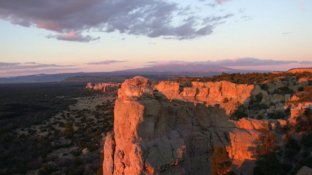
Sandstone Bluffs Overlook offers a broad view of the dark lava flows below and surrounding mountains. The pale sandstone underfoot contrasts with the younger volcanic rock in the valley. From a designated viewpoint, the scale of the flows becomes easier to understand than it does from a road at their edge.
The overlook is generally open from sunrise to sunset, subject to current restrictions. There is no established hiking trail across the bluffs, and the NPS warns of deep cracks and steep drop-offs. Keep children close, watch your footing and remain well back from edges, especially in wind or wet conditions.
Bring binoculars if you enjoy scanning for distant landforms or birds. Stop in a safe place before looking through a camera or across the horizon. A few minutes of careful observation can make this a rewarding stop even if you do not attempt a longer walk.
3. Walk the Lava Falls loop only when prepared
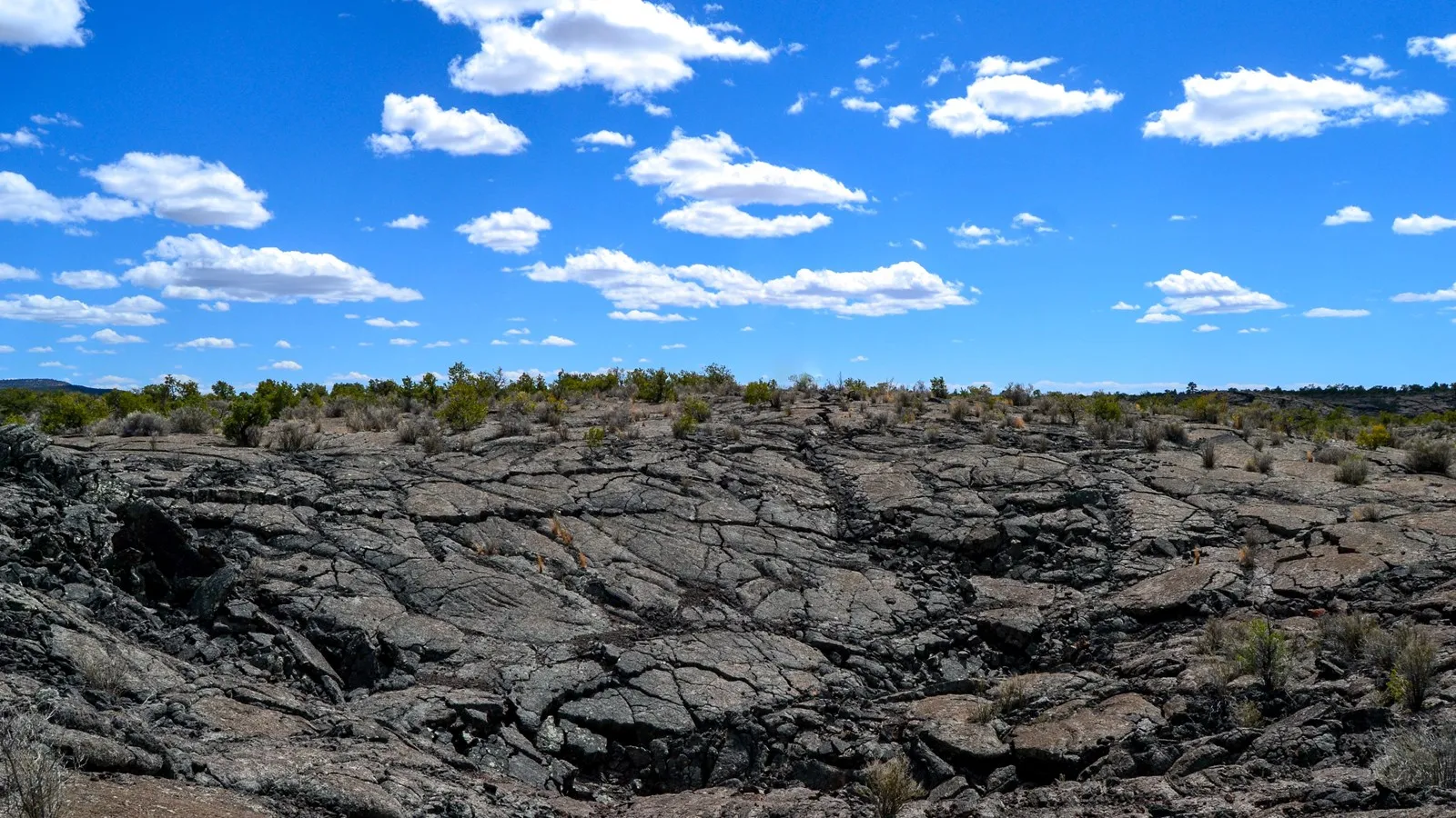
The Lava Falls Trail is a roughly one-mile loop across the McCartys lava flow. It is short in mileage but rough and uneven underfoot. The NPS says the route is marked by cairns, or rock piles, because a conventional tread is difficult to maintain on the lava.
Before moving from one marker, locate the next one. Look back periodically so the return route remains familiar, and do not disturb existing cairns or build new ones: additional piles can mislead other hikers. Wear sturdy shoes, carry water and gloves if appropriate, and avoid the route when ice, storms or poor visibility make the footing unsafe.
Sharp lava can injure paws; the park does not recommend this hike for pets. If the route seems beyond your group’s comfort or the markers are difficult to follow, turn back. A short distance is not a reason to underestimate volcanic terrain.
4. Appreciate the geology without taking pieces home
El Malpais contains several major lava flows of different ages. The NPS describes forms including rough, blocky ʻaʻā and smoother, ropy pāhoehoe. At Lava Falls, features such as pressure ridges and cracks show how flowing rock cooled and deformed.
The landscape also holds cultural meaning for communities connected to the region. The Zuni-Acoma Trail follows a historic route between the Zuni and Acoma areas; it is a demanding crossing of rugged lava, not a casual shortcut. Check current conditions, distance and shuttle logistics before considering any portion.
Leave rocks, plants and cultural materials in place. Stay away from fissures and unstable edges, and avoid entering caves without the permits, equipment and current access required by the park. Many lava tubes are sensitive bat habitat as well as challenging environments for people.
5. Plan for weather, water and a safe return
The monument’s open terrain offers little protection from lightning, intense sun or sudden wind. Carry more water than you expect to need, use sun protection and check the forecast. In a thunderstorm, move to an appropriate enclosed shelter or vehicle and follow park guidance; do not wait on an exposed bluff for a better view.
Cell coverage and services may be limited. Tell someone where you are going, download directions and leave enough daylight for the return. Ask rangers about accessibility and shorter alternatives if rough lava is not suitable for your party.
Pack out litter, give wildlife space and check the NPS alerts again before departure. El Malpais is a landscape best enjoyed with patience, solid footing and a willingness to change plans.