New Mexico’s landscapes can change dramatically over the course of a road trip: a high volcanic valley gives way to a deep river gorge, dark lava fields or brilliant white dunes. The distances between them are substantial, but that variety is a good reason to slow down and build a trip around a few places rather than trying to see everything at once.
These five public-land stops offer different perspectives on the state. They are spread across northern and southern New Mexico, so treat them as an idea bank for a longer journey, not a one-day itinerary. Check road, weather and park conditions before each leg.
1. Valles Caldera: a mountain valley inside an ancient volcanic landscape
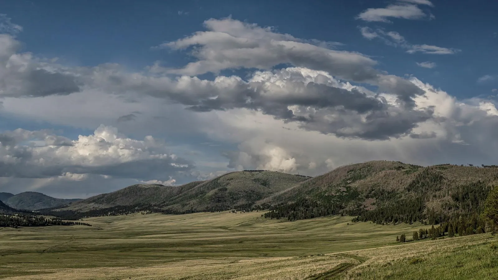
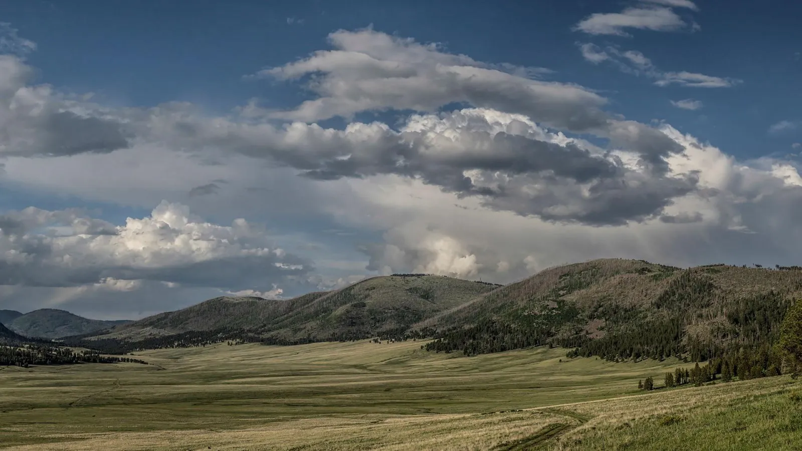
On NM 4 between Los Alamos and Jemez Springs, Valle Grande opens into a broad grassland surrounded by wooded slopes and volcanic domes. A designated pullout offers a first view, while the preserve’s main entrance leads toward the Cabin District and Volcano Discovery Center.
Stop for interpretation and current advice before choosing a walk. The NPS shares the continuing connection between Jemez Pueblo and this landscape alongside its geological history. Stay on permitted routes and leave cultural materials and plants undisturbed.
Driving beyond the Cabin District requires a limited backcountry vehicle pass and is subject to seasonal and weather-related closures. Gravel roads can be rough, and high-clearance vehicles are recommended for the backcountry. If that route is closed or does not suit your vehicle, the front-country view can still make a worthwhile stop.
2. Río Grande Gorge: a high bridge and a river corridor
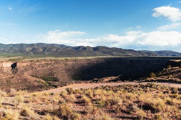
North of Taos, the Río Grande has cut a deep gorge through a volcanic plateau. The High Bridge Overlook near the U.S. 64 crossing gives visitors a sense of the canyon’s scale from above. Use designated parking and pedestrian areas, stay behind barriers and watch for traffic and strong winds.
For a different perspective, the BLM’s Orilla Verde Recreation Area offers designated river access and camping areas south of Taos. Farther north, Wild Rivers has overlooks and routes into the gorge. Check fees, road conditions and trail details before choosing a stop; many gorge trails involve a steep descent and an equally demanding climb out.
The landscape also played a role in space history: Apollo 15 astronauts trained near the gorge in 1971 to practice geological observation before their Moon mission. Visitor-center information can help connect that story to the rocks and terrain visible today.
3. El Malpais: dark lava beneath sandstone cliffs
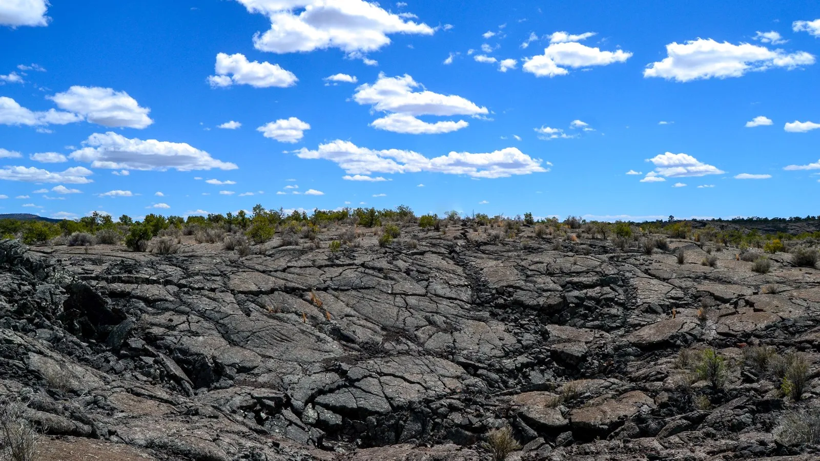
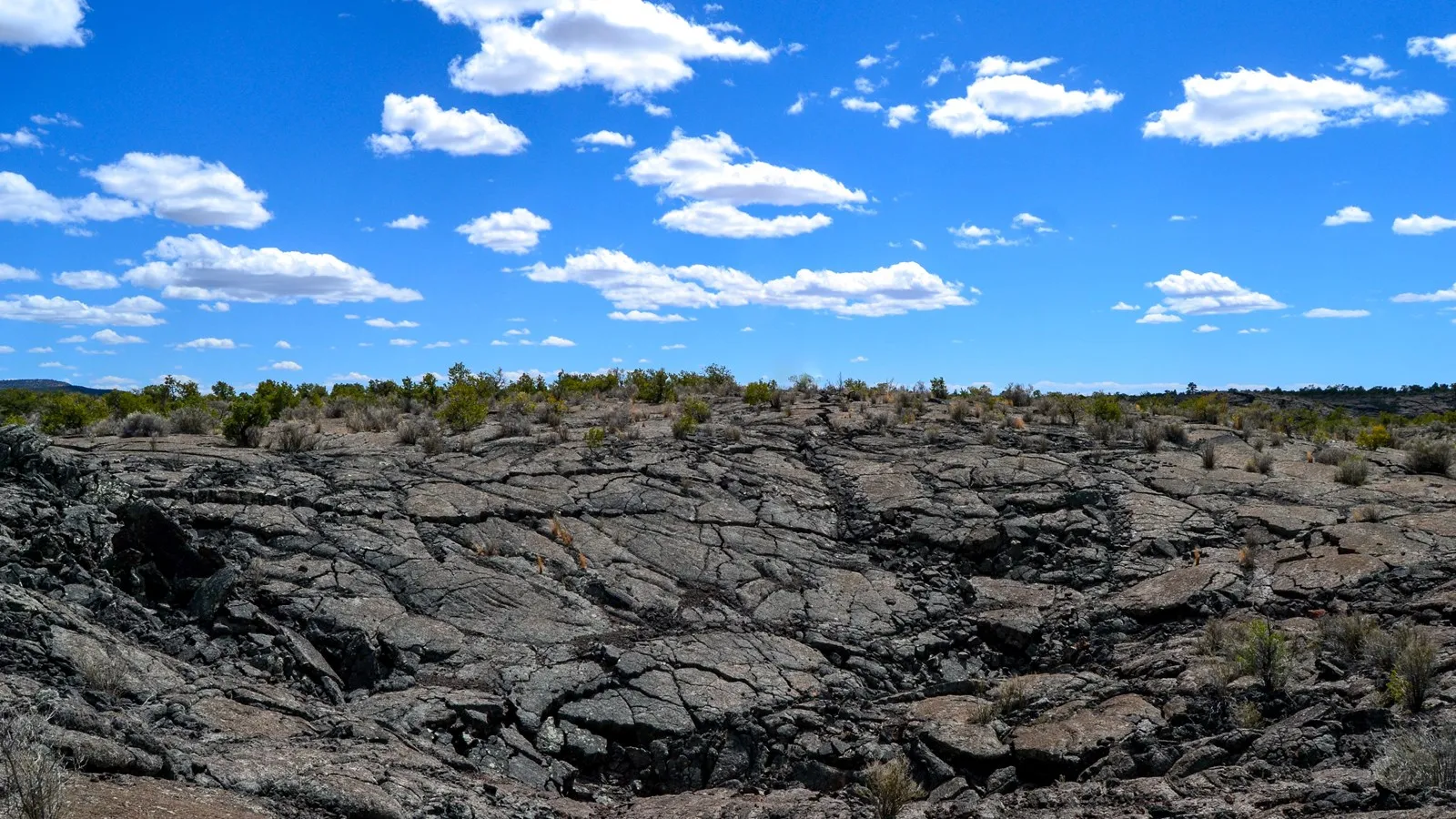
West of Albuquerque near Grants, El Malpais National Monument protects rugged volcanic flows. Sandstone Bluffs Overlook gives a broad view over dark lava and distant mountains, while the one-mile Lava Falls loop crosses jagged rock marked by cairns. Short mileage does not mean easy footing: wear sturdy shoes, carry water and know how to follow the route.
The NPS reported the El Calderon Trail closed for construction through November 2026 and closes lava-tube caves seasonally from November 1 through April 30 to protect bats. Check the latest alerts before travel, since project schedules, weather and road conditions can change. Caving has separate permit and equipment requirements when access is allowed.
At the bluffs, keep well back from cracks and steep edges. Do not disturb trail cairns or remove rocks. If lightning or poor visibility develops, an overlook from a safer location or a visitor-center stop is a better choice than an exposed hike.
4. Bosque del Apache: wildlife along the Río Grande
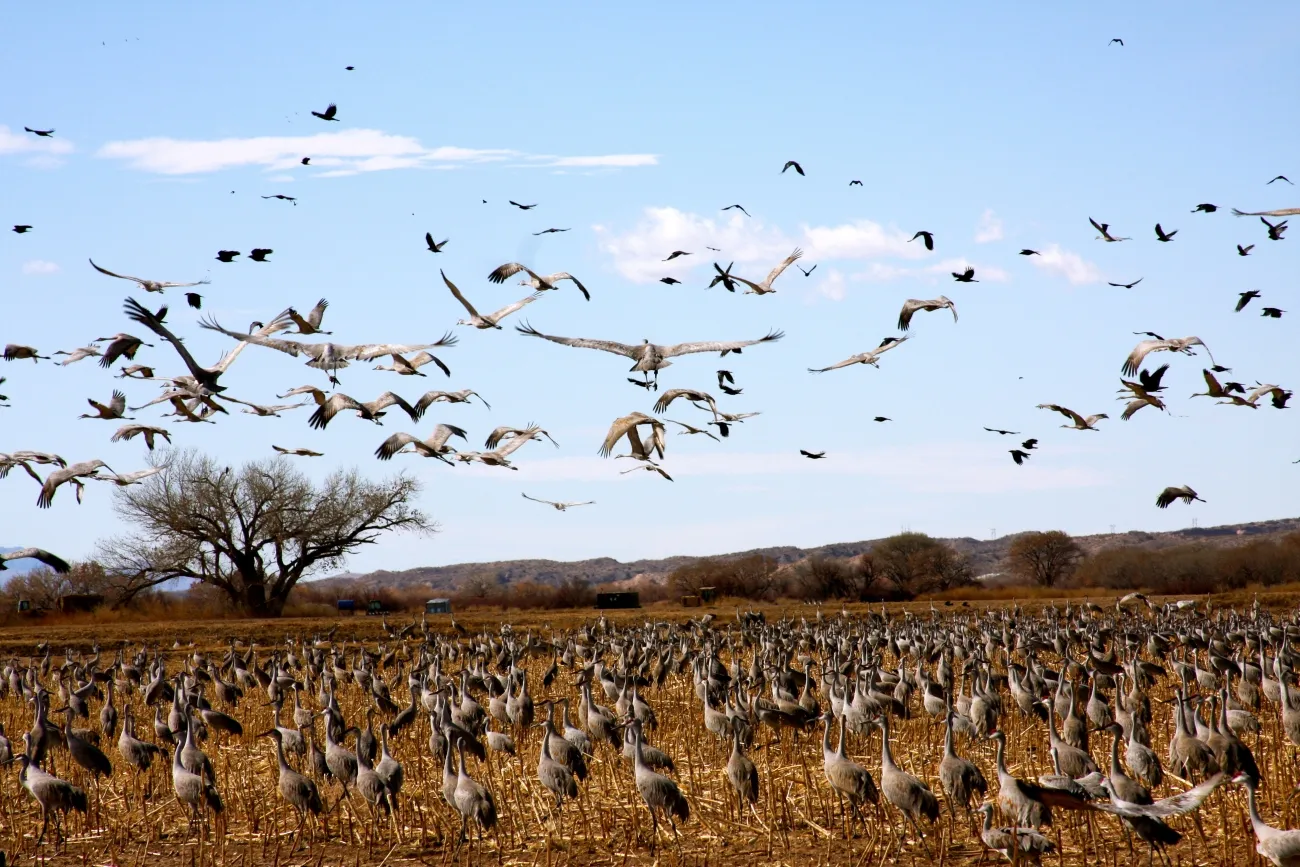
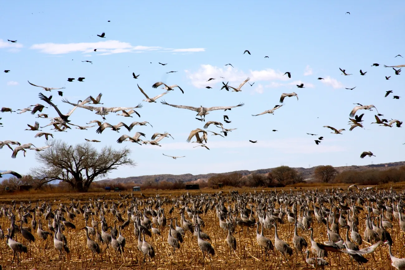
South of Socorro, Bosque del Apache National Wildlife Refuge offers a change of pace from rock and high desert. Wetlands and fields attract a wide range of birds; USFWS says the largest numbers generally occur from early November through late January, when sandhill cranes and geese are among the winter visitors.
The approximately 12-mile Scenic Drive passes habitats where patient observers may see waterfowl, raptors and other wildlife. Bring binoculars, use designated pullouts and stay far enough away that animals continue feeding or resting. Sightings and roost locations change, so check the refuge’s current information and ask staff for guidance.
Refuge lands generally open one hour before sunrise and close one hour after sunset; visitor-center hours differ. Fees apply, and prescribed fire or habitat work may affect access. Camping and overnight parking are not allowed on the refuge, so arrange lodging elsewhere.
5. White Sands: a gypsum dunefield unlike a snowy landscape
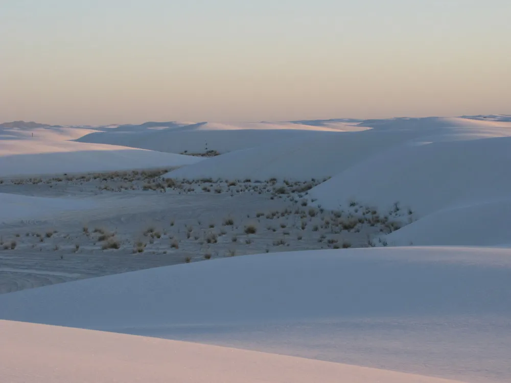
White Sands National Park’s bright dunes are made of gypsum shaped by wind and water in the Tularosa Basin. Dunes Drive runs eight miles from the visitor center into the dunefield. Allow time for stops, carry water from the visitor center and drive carefully on the packed gypsum section.
The park’s safety-corridor guidance restricts stopping along a section of the drive and closes the Interdune Boardwalk; confirm the current boundaries at the visitor center. Military tests can temporarily close Dunes Drive and sometimes Highway 70. Check official closure notices shortly before setting out.
Sledding is permitted in appropriate areas, but choose a gentle slope with a clear, level runout away from roads and vegetation. Sit or lie feet first, supervise children and ask staff where the activity is currently allowed. The NPS advises against hiking during high heat; bring water, sun protection and a plan for changing weather.
These stops cross different elevations, climates and communities. Check driving times, fuel and lodging before linking them together, and leave room for local businesses and unplanned breaks. A flexible route makes it easier to enjoy New Mexico’s contrasts without spending the whole trip behind the wheel.