The North Unit of Theodore Roosevelt National Park offers a different introduction to North Dakota's badlands. A road follows the Little Missouri River valley before climbing toward broad overlooks, while rounded rock formations, prairie and wildlife invite slower stops along the way.
The North Unit is separate from the park's South Unit near Medora. It is reached from U.S. Highway 85, about 14 miles south of Watford City. These five stops and ideas can help you plan a first visit without underestimating the distance, weather or time needed to explore.
1. Follow the scenic road into the badlands
The North Unit scenic drive is 14 miles one way, ending at Oxbow Overlook. The National Park Service suggests allowing at least an hour and 15 minutes for the 28-mile round trip without adding lengthy stops. Give yourself more time if you plan to walk, photograph the landscape or watch wildlife.
The route begins in the lower badlands and climbs toward the rim. Most of the road is paved, although the park notes a gravel section. Check current road conditions before setting out, particularly during winter when snow and ice can close portions of the route. Fill your fuel tank and carry water before entering the park.
Use designated pullouts rather than stopping in a travel lane. The road has curves and changing grades, and another driver may not be able to see a stopped vehicle in time. The scenery is best appreciated from a safe place where everyone can look around.
2. Look closely at the cannonball concretions
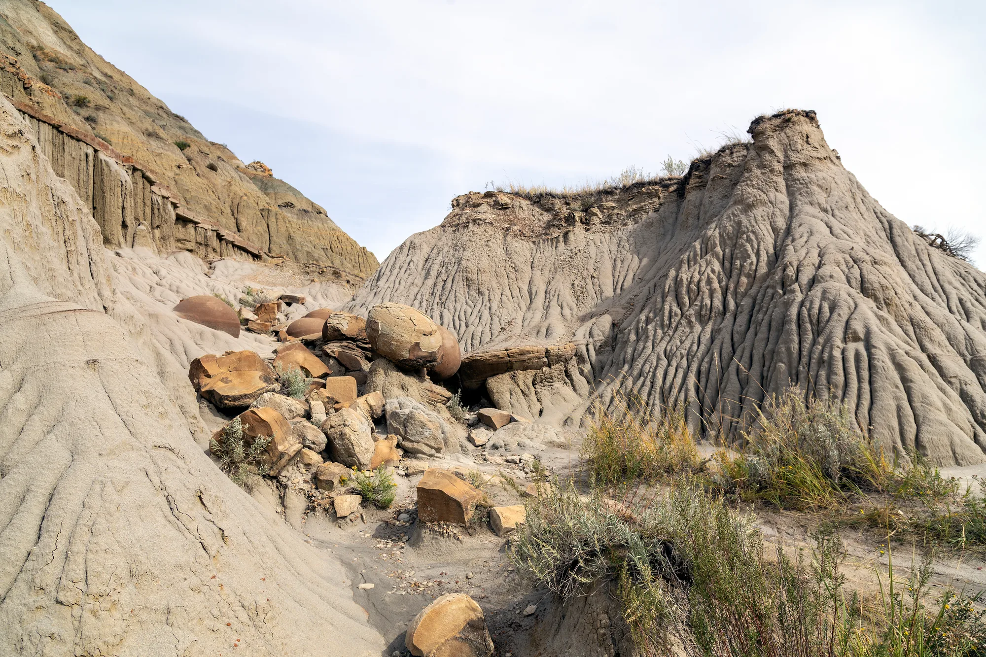
The Cannonball Concretions Pullout is named for rounded mineral-cemented formations exposed in the badlands. Their spherical shapes stand out against the softer, eroded surrounding material. They are a useful reminder that a striking landscape can contain details worth studying at close range as well as views across miles of prairie.
Take your time at the signed area and read the park's interpretation. Do not remove rocks or climb on fragile formations for a photograph. Erosion is part of the natural story, and visitors can help protect what remains by staying on durable, designated surfaces.
The pullout also provides access to trails, but a trailhead does not commit you to a long hike. Ask at the visitor center which routes are appropriate for the conditions and your available time. Heat, wind and wet clay can turn a straightforward-looking walk into a more demanding one.
3. Pause at River Bend Overlook
Farther along the road, River Bend Overlook opens toward the Little Missouri River and its winding valley. The view makes the scale of the North Unit clear: layered slopes descend toward the river while grassy uplands extend beyond the immediate rim.
The park identifies a compacted-gravel route to the viewing deck. Visitors with mobility concerns should consult the National Park Service's detailed accessibility information and ask about current surface conditions before traveling. Weather, repairs and individual needs can affect whether a route is practical.
Wind and loose material deserve attention at exposed overlooks. Keep children close, stay behind any barriers and avoid stepping onto unstable edges for a wider photograph. Let the river and the shape of the valley provide the drama.
4. Continue to Oxbow Overlook
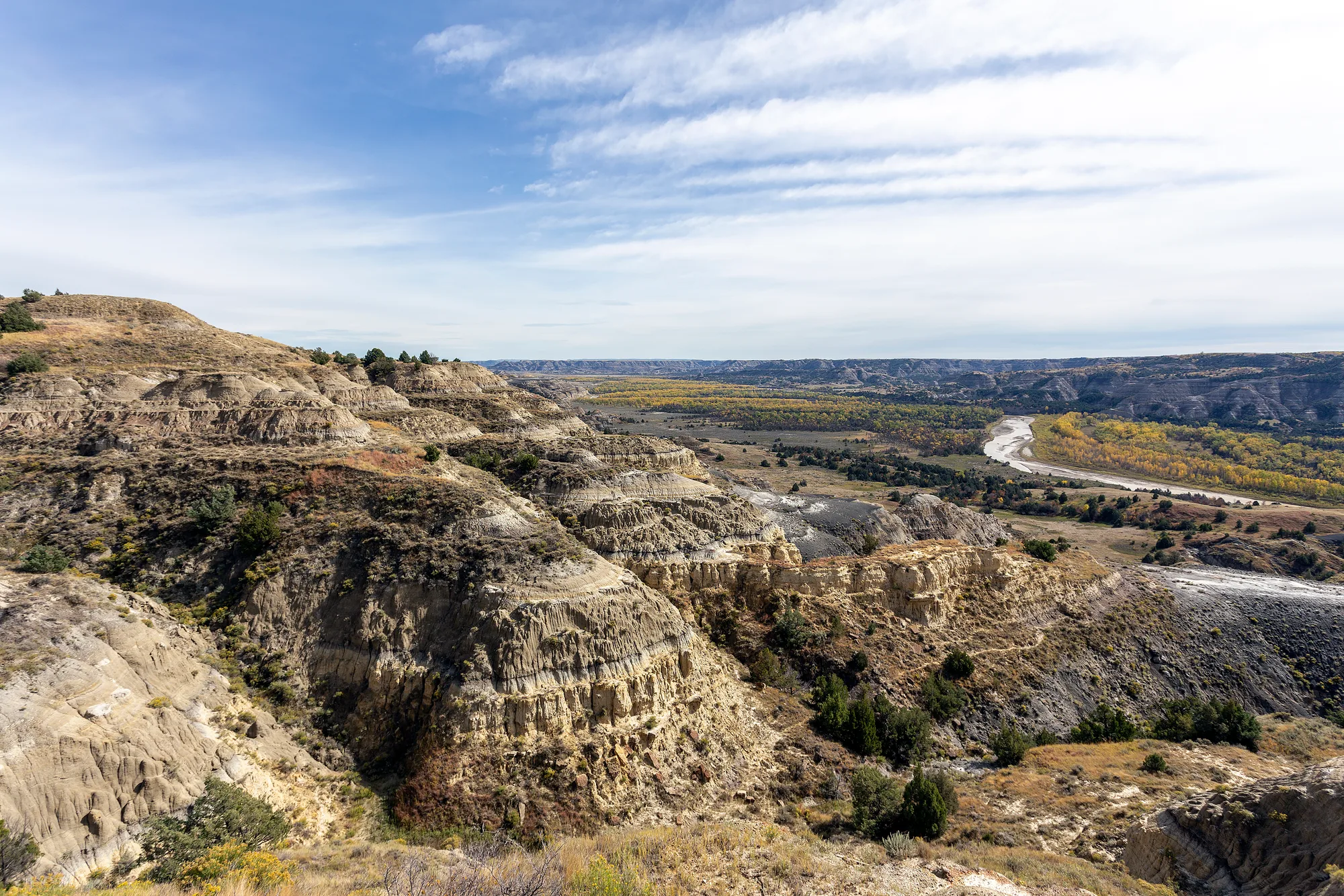
At the end of the scenic road, Oxbow Overlook offers another view of the Little Missouri's meandering course. The National Park Service explains that its name refers to the type of bend visible in the river landscape. A paved path along the rim and interpretive exhibits provide a place to pause before the return drive.
Look back across the valley and compare this viewpoint with River Bend. Different angles reveal how the river has helped shape the surrounding badlands. Light changes the appearance of the slopes throughout the day, but allow enough time to return safely and do not rely on a particular sunset or weather condition.
Oxbow is also a trail access point. Longer backcountry routes require preparation beyond a roadside visit; speak with park staff about distance, water, navigation and permits before heading out. Overnight backcountry travel requires a permit according to the park.
5. Choose a walk and watch for wildlife responsibly
The North Unit has short nature walks as well as longer wilderness routes. The National Park Service lists the Caprock Coulee Nature Trail as a 0.8-mile section of a longer trail. The Little Mo Nature Trail provides another option; review current trail descriptions and accessibility guidance before deciding which works for your group.
Carry drinking water and sun protection even on a short walk. Badlands clay can become extremely slippery when wet, and exposed routes offer limited shelter from storms or heat. A forecast, a paper or downloaded map and sturdy footwear are useful even when a trail appears modest on the map.
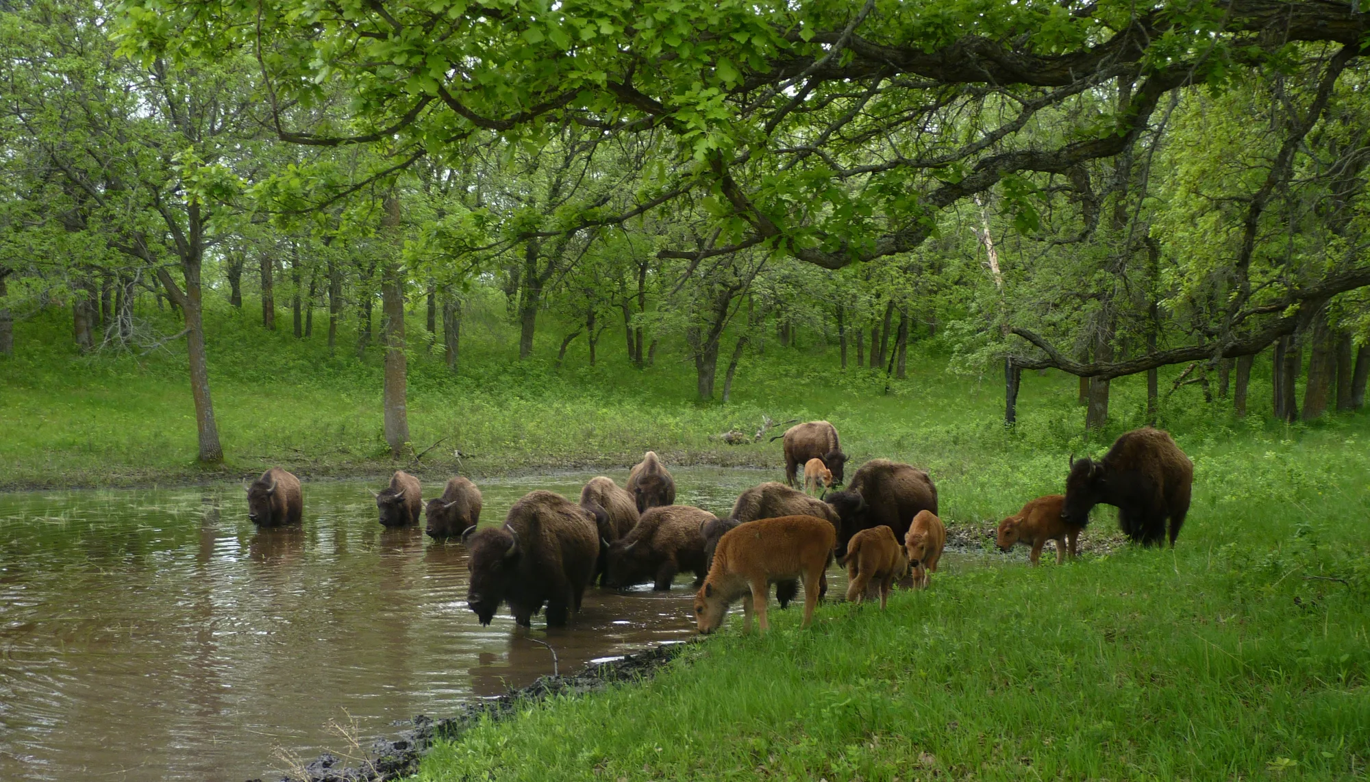
Bison and other wildlife move through the park. Observe from a safe distance, never feed animals and use binoculars rather than approaching. If an animal stands on the road or trail, give it room and be prepared to wait or turn around. Wildlife sightings are a possibility, not a promise.
Before you leave
The North Unit operates on Central Time; the South Unit near Medora operates on Mountain Time. That difference is easy to overlook when planning a longer park trip. The National Park Service estimates about an hour and ten minutes of driving between the two main units, before stops or weather delays.
Check park alerts, road status, visitor-center hours and entrance requirements close to your visit. With a full tank, enough water and a flexible schedule, the North Unit can be a memorable day of overlooks and short walks through a landscape that rewards patience.