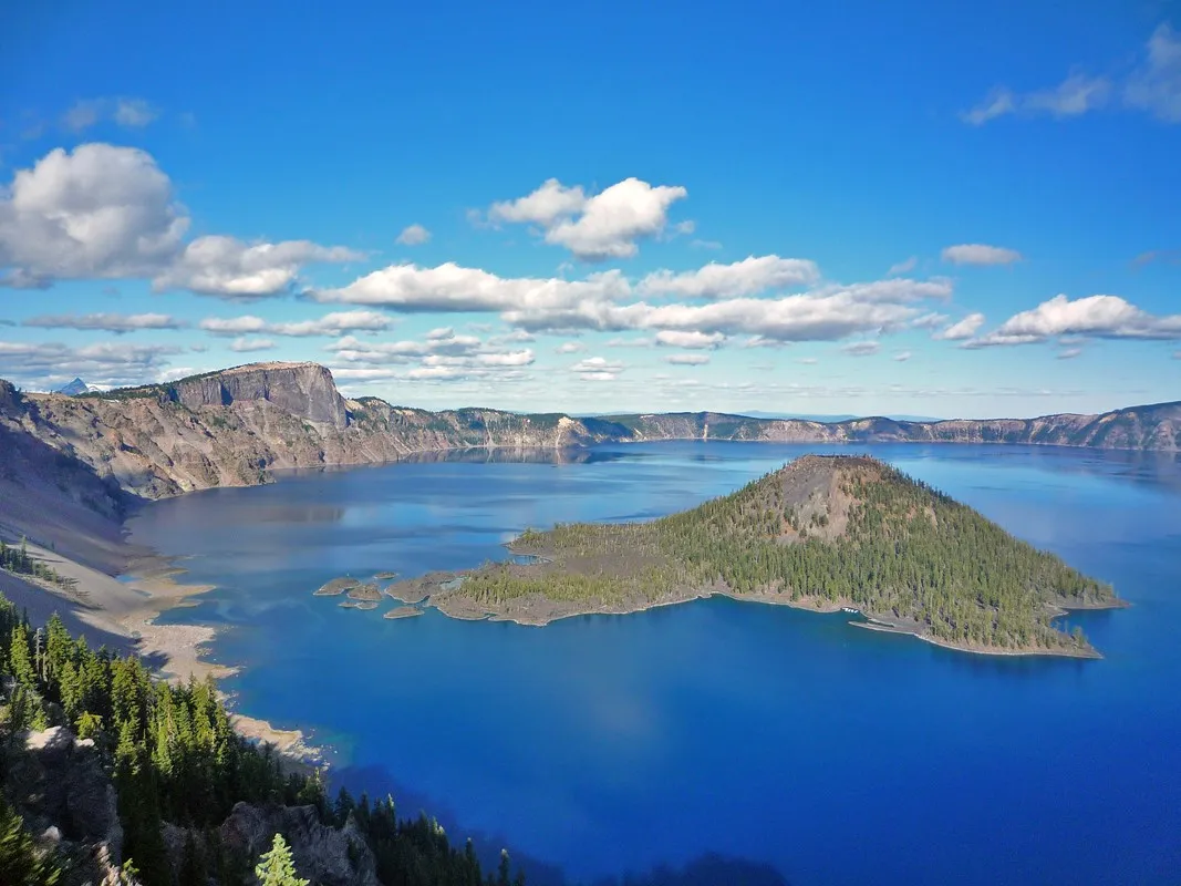
Crater Lake’s deep blue water fills a volcanic caldera high in Oregon’s Cascade Range. On a clear day, Wizard Island and the steep rim make the view unforgettable. Yet a successful visit depends as much on snow, road openings and visibility as on the calendar.
These six details will help you plan a first trip, understand a major trail closure and appreciate the history and living significance of the landscape. Check the National Park Service’s current conditions before leaving; the park’s seasons differ sharply.
1. Check the roads before choosing an entrance
The park is open year-round, but many roads close during the long winter. The NPS says the North Entrance Road and Rim Drive generally close to vehicles on November 1 or earlier after significant snowfall. The south and west approaches on Highway 62 are maintained year-round, subject to weather.
The road from park headquarters to Rim Village is plowed when possible but may close during or after heavy snow. As of the park’s current conditions page in November 2026, the road to Rim Village, Rim Drive and the north entrance were closed. Check the live status before driving: reaching the entrance does not guarantee access to a lake view.
Winter traction requirements can apply, and even plowed roads may be icy. Consult Oregon road information and park guidance, fill the fuel tank before arriving and carry supplies for delays. Cell service is limited, so download directions and a map.
2. Give the weather a vote
Snow can linger well into the warmer months, and clouds sometimes hide the lake entirely. Check the forecast and the park webcam close to departure. A clear forecast at lower elevation does not guarantee clear roads or visibility at the rim.
Bring layers, sturdy footwear, water and sun protection. Snow, wind and bright reflected light can make conditions feel very different from a town below the mountains. If visibility is poor, consider changing the day or spending time at the open information center rather than forcing a hazardous drive.
In summer, wildfire smoke and construction can also affect views or routes. The official alerts page is more reliable than a photograph or travel post from a previous season. Keep the itinerary flexible and allow extra time for changing conditions.
3. Understand what you are looking at
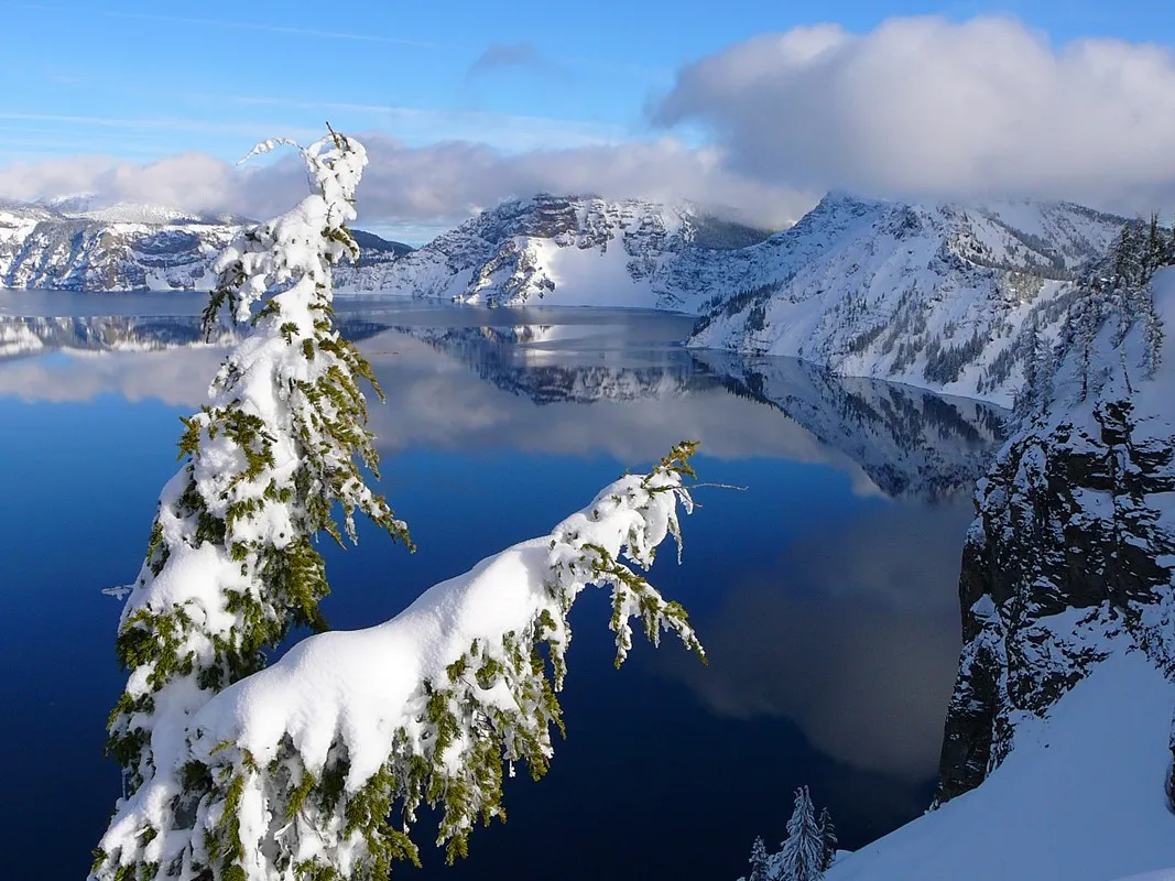
The lake formed after a major eruption and collapse of Mount Mazama about 7,700 years ago. Rain and snow now supply the lake. Wizard Island is a volcanic feature within the caldera, visible from many open viewpoints when weather permits.
Indigenous people witnessed and have enduring connections to this landscape. Learn from the park’s interpretation and the perspectives of Native communities; the lake is more than a geological curiosity. Leave rocks and plants in place and treat the landscape with care.
Use designated overlooks and stay behind barriers. Snow can form an unstable overhanging cornice near the rim, and steep ground can be dangerous in any season. Keep children close and do not approach an edge for a photograph.
4. Know about the Cleetwood Cove closure
The Cleetwood Cove Trail is the only legal public route to the lake shore. The NPS states that the trail is closed for a major rehabilitation project until 2029. Do not plan on hiking down, swimming from the shore or taking a boat based on older guides; check the park’s project and current conditions pages for updates.
There are still opportunities to experience the lake from open rim viewpoints when roads and weather allow. Ask staff which overlooks and facilities are accessible on the day. A visitor center, a short walk or an open viewpoint can be a worthwhile alternative to a more ambitious itinerary.
Never attempt an unofficial descent to bypass a closure. The caldera walls are steep and unstable, and restrictions protect both visitors and the lake. Respect all signs and construction boundaries.
5. Choose walks for the season and the group
When roads and trails are open, the rim area offers a range of viewpoints and hikes. Ask a ranger for current conditions and select a route that matches everyone’s fitness and experience. Snow can obscure a trail long after a valley has warmed, while exposed ridges may be windy even in summer.
In winter, snowshoeing and cross-country skiing can be possible, but they require equipment, navigation skills and attention to avalanche and weather conditions. Follow NPS winter safety advice, travel with appropriate companions and tell someone your plan. Do not assume a summer trail is safe or visible under snow.
Accessibility varies by site and season. Contact the park for current information about parking, paths and facilities if these details are essential for your party. Weather and plowing can change the practical accessibility of an otherwise suitable viewpoint.
6. Plan fuel, food and a safe return
Lodging, camping, food and fuel services vary seasonally. Check current concession information before relying on a particular restaurant, campground or gas pump. Bring enough water and food for the trip, and arrange accommodation outside the park if your preferred facilities are closed.
Give yourself daylight and a margin for the return drive, particularly in winter. If conditions deteriorate, follow road closures and staff instructions; turning around is a sound plan when the lake is hidden or roads are unsafe.
Before leaving, review the park’s current conditions, road status and webcam. The view is memorable when it appears, and a flexible plan gives you the best chance to enjoy it safely.