Oregon’s coast, mountains and high desert can feel like several different trips in one state. A lighthouse above Pacific tidepools, a deep volcanic lake and bands of ancient soil in the Painted Hills each reward a slower look.
These five destinations are widely separated. Use them as building blocks for a longer road trip rather than trying to squeeze them into a single day. Check seasonal roads and opening hours, book lodging in advance when needed and leave time for the communities between stops.
1. Cannon Beach and Haystack Rock
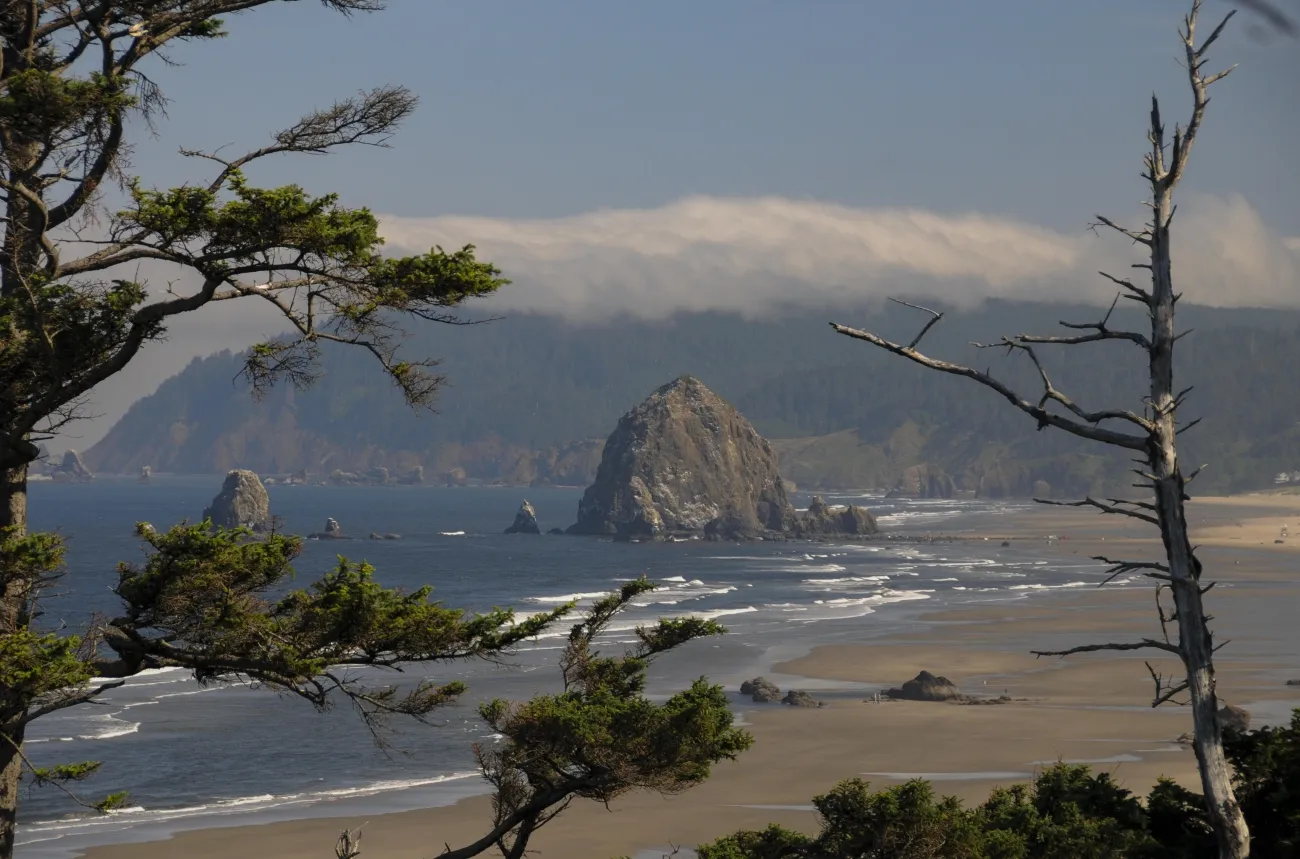
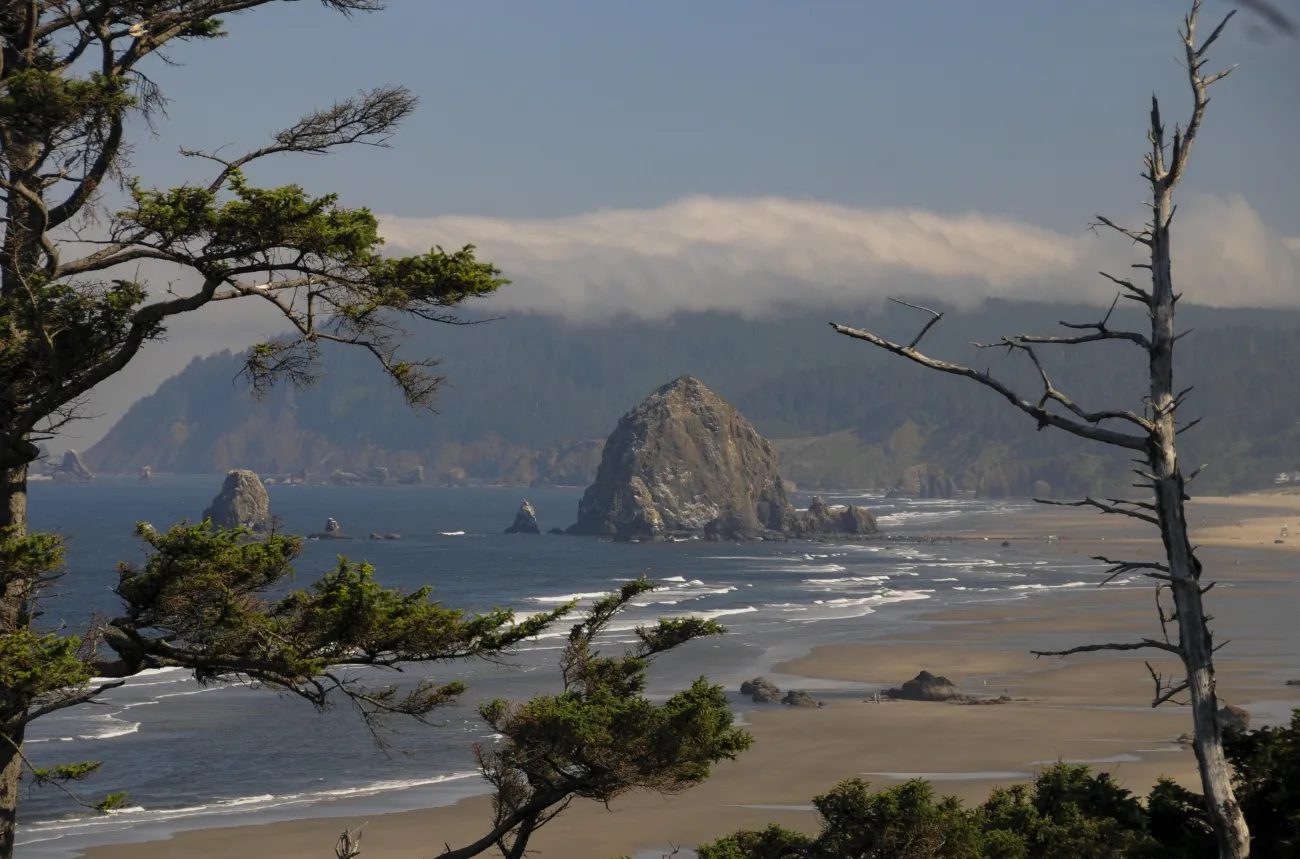
On the north coast, Haystack Rock rises above a sandy beach and provides habitat for nesting seabirds. The rock is part of Oregon Islands National Wildlife Refuge; its protected areas are closed to public entry. Watch birds from the beach with binoculars and follow posted boundaries rather than climbing onto the rock.
Check tide tables and ocean conditions before walking near the shore. Incoming water can cut off a route, and sneaker waves can arrive unexpectedly. Keep children close, stay away from logs near the surf and leave tidepool animals and rocks in place.
The town of Cannon Beach offers a place to pause for a meal or supplies. Nearby Ecola State Park provides another coastal perspective, although the state has posted a landslide closure on the west section of the Clatsop Loop Trail. Check the current park notice and parking requirements before adding it to your day.
2. Yaquina Head’s lighthouse and tidepools
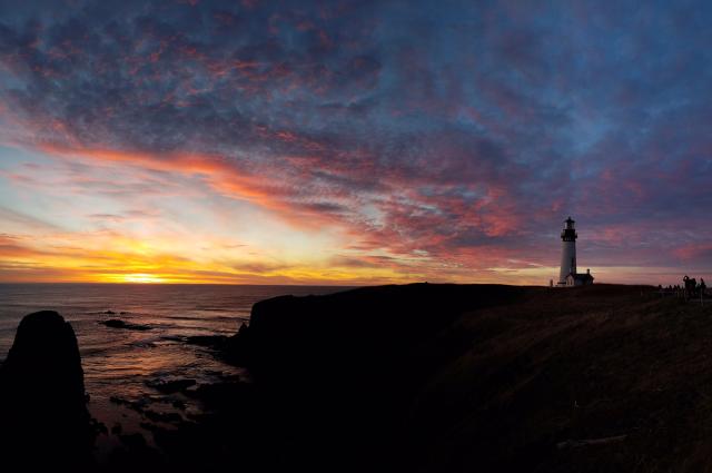
Near Newport, Yaquina Head Lighthouse has guided mariners since 1873. The BLM-managed headland also has an interpretive center, wildlife viewpoints and tidepools. Ask staff about current hours, fees, tours and wildlife closures when you arrive; guided lighthouse tours have limited capacity and advance reservations are recommended.
At Cobble Beach, a low tide can reveal sea stars and anemones, but tide height alone does not make the coast safe. High surf and sudden waves can sweep across the rocks. Wear non-slip shoes, observe from a safe distance and never remove animals or natural objects.
Seabird nesting or harbor seal pupping can restrict access to parts of the area. Follow signs, bring binoculars and give wildlife room. If the shore is closed or the ocean is rough, an open observation deck can still offer a memorable view.
3. Crater Lake’s volcanic rim
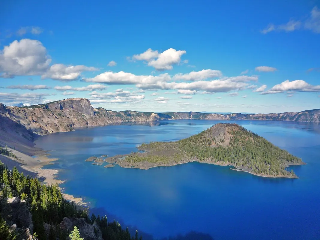
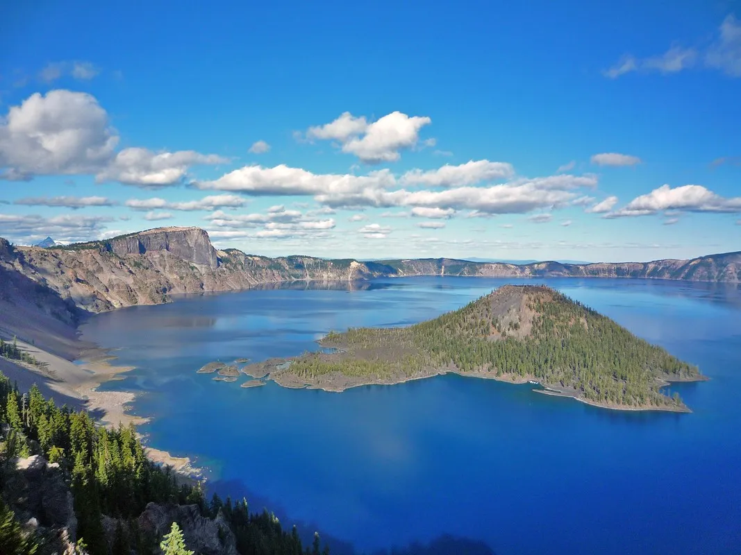
High in the Cascades, Crater Lake fills a caldera formed after Mount Mazama erupted and collapsed about 7,700 years ago. The lake is fed by rain and snow, and Wizard Island is one of its recognizable volcanic features. Indigenous peoples witnessed the landscape’s formation and maintain enduring connections to the area.
Road access depends heavily on season and weather. The NPS reported Rim Drive and the north entrance closed for the season in November 2026; the road from headquarters to Rim Village can also close in heavy snow. Check the live road status, forecast and webcam before driving, and carry winter traction equipment when required.
The Cleetwood Cove Trail, the only legal public route to the lake shore, is closed for rehabilitation until 2029 according to the NPS. Plan on open viewpoints rather than swimming or boat access, and never attempt an unofficial descent. Give yourself flexibility if clouds hide the lake.
4. The Painted Hills and ancient layers
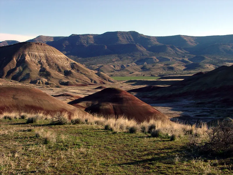
Near Mitchell in central Oregon, the Painted Hills Unit of John Day Fossil Beds National Monument shows bands of red, gold, tan and dark sediment. The half-mile Painted Hills Overlook Trail offers broad views; Carroll Rim provides a longer climb, and Painted Cove gives a close view from a protected route.
These hills are scientifically valuable and fragile. Stay on designated trails and boardwalks, and do not collect fossils or step onto the colored slopes. The NPS’s “Don’t Hurt the Dirt” guidance explains why even a small footprint can damage the landscape.
Bring water and sun protection, and check road conditions after rain. The park does not recommend large RVs or trailers beyond the overlook area. The other units of John Day Fossil Beds are separated by significant driving distances, so check a map before combining them with the Painted Hills.
5. Malheur’s wildlife and Blitzen Valley
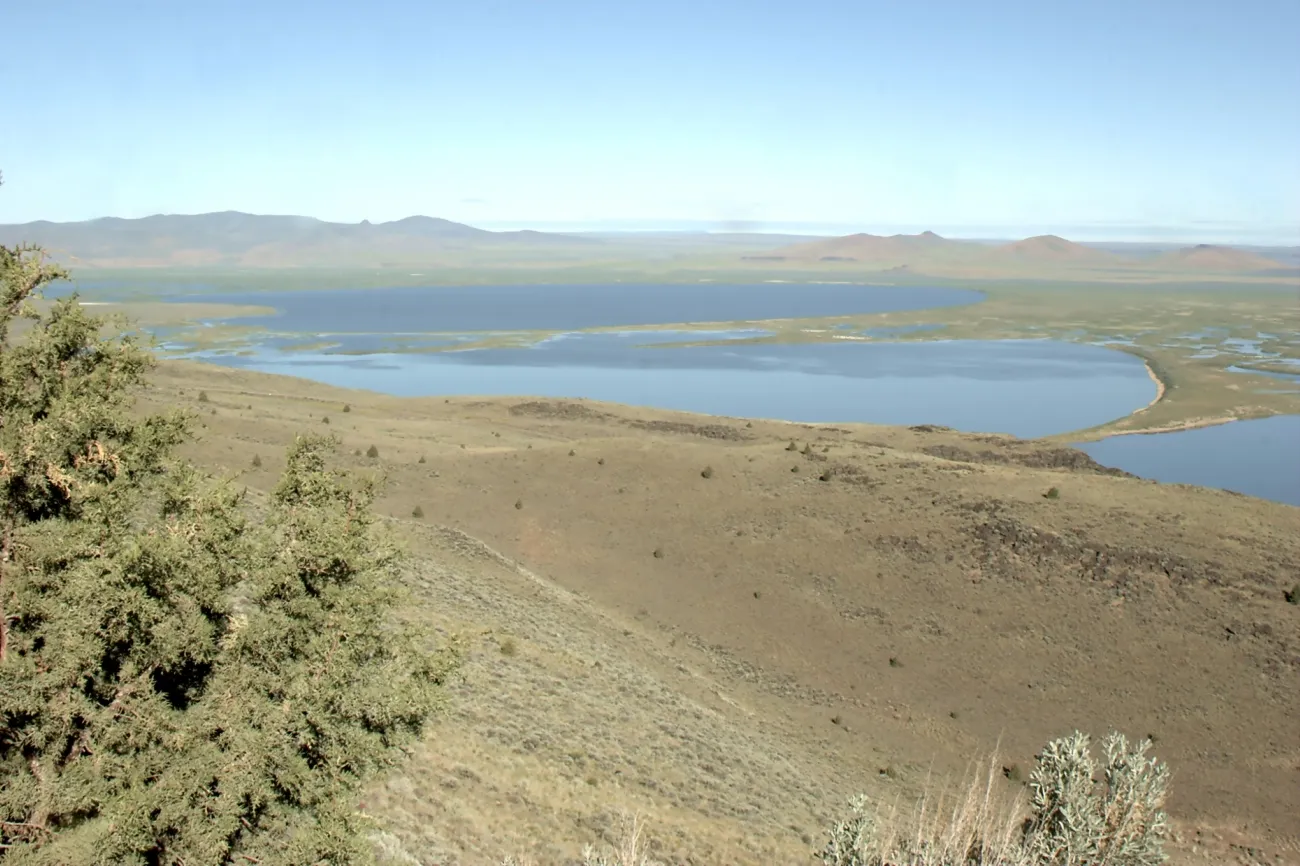
In southeastern Oregon, Malheur National Wildlife Refuge protects wetlands, meadows and sagebrush country along the Pacific Flyway. USFWS says the greatest variety of waterfowl and songbirds is generally present from late winter through May, though wildlife can be seen in other seasons.
The self-guided Blitzen Valley auto tour runs 42 miles from refuge headquarters to historic P Ranch, mostly on gravel. Allow at least two hours and longer for birdwatching. Carry fuel, food, water and a downloaded map; the refuge has no lodging, camping, fuel or food services and cell coverage can be unreliable.
Check current road conditions before setting out and use only routes posted as open. Binoculars allow wildlife viewing without approaching animals, and refuge rules prohibit using audio devices to lure birds. Leave plants, feathers and cultural objects where they are.
Oregon’s distances and weather deserve as much planning as the destinations. Build in rest days or shorter legs, support local businesses and be willing to change a route when snow, wildfire, surf or road work makes another choice safer.