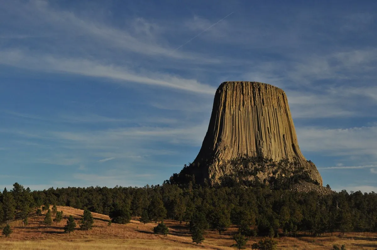
The first glimpse of Devils Tower can make a Wyoming road trip feel as though it has acquired a destination of its own. The tall rock formation rises above forest and prairie in the northeast corner of the state, and its vertical columns become more impressive as the road winds closer.
There is more to a rewarding visit than finding the best angle for a photograph. Short walks reveal prairie dogs and broad river-valley views, while longer trails circle through red earth and pine forest. The Tower is also a sacred place for many Native American tribes. Give yourself time to learn about that living connection as well as the geology.
1. Start with the view from the road
Devils Tower is visible from Wyoming Highway 24 before you reach the monument entrance. The National Park Service identifies a state historic marker south of the park road where travelers can see it from outside the monument. That first distant view provides a useful sense of scale: the formation appears above a rolling landscape rather than in isolation.
Once inside, follow signs and use designated pullouts rather than stopping in the road. Traffic can build in summer, and parking near the visitor center is limited. The park recommends arriving before 10 a.m. or after 4 p.m. to avoid the busiest parking period, especially from May through September.
2. Walk the Tower Trail for a close look
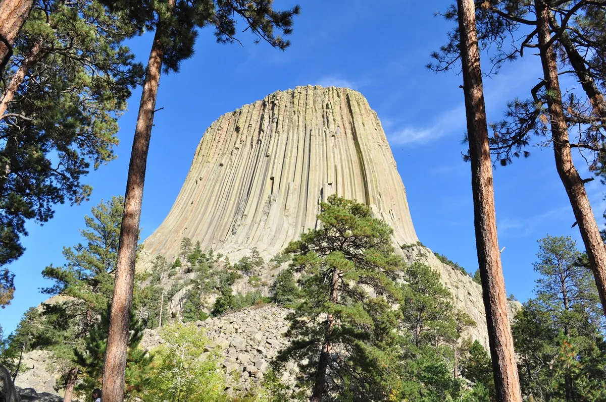
The paved Tower Trail is the classic first walk. It circles the formation, letting you see how the columns and boulder field change with each bend. Benches and interpretive signs offer reasons to pause, so this is a route that rewards taking your time rather than rushing around the loop.
The loop itself is 1.3 miles, but the Park Service describes the full outing from the parking area, including the approach, as approximately 1.8 miles. There are moderate changes in elevation. An accessible concrete path reaches the loop intersection, but the Park Service advises against taking wheelchairs or power scooters beyond that point. Check current trail conditions before setting out, especially after snow or ice.
3. Make room for the prairie dogs
Near the Belle Fourche River, a prairie dog town adds a completely different kind of stop. Look from the paved roadside pullouts or explore on foot via the South Side or Valley View trails. These small animals are entertaining to watch, but their burrows also help support a larger prairie ecosystem.
Bring binoculars or a camera with a zoom lens and watch from a distance. Do not feed or approach the animals, and keep pets away from wildlife. Prairie dogs may be harder to spot in cold winter weather, so an unhurried visit during the warmer seasons improves your chances.
4. Choose a quieter trail
If the Tower Trail is busy, Joyner Ridge offers a broader landscape perspective. The 1.5-mile loop is reached by a dirt road to a small trailhead parking area. It includes a noticeable elevation change, but the reward is a view of the Tower set against prairie and forest rather than filling the entire frame.
For a longer walk, the 2.8-mile Red Beds Trail loops through changing terrain and includes steep sections. The 0.6-mile Valley View Trail, by contrast, has little elevation change and can be a gentler way to see the river valley and prairie dog town. These distances describe individual trails, so check a park map before combining routes.
5. Respect a living sacred place
For many Native American tribes, the Tower is far more than a scenic landmark. It remains a place of cultural and spiritual importance. Visitors may notice prayer cloths or small bundles tied to trees near the Tower Trail. Leave them undisturbed; the Park Service notes that some people consider photographing them culturally insensitive.
The park asks climbers to voluntarily refrain from climbing the Tower or scrambling inside the Tower Trail loop during June, a culturally significant period for many affiliated tribes. Some climbing routes may also close seasonally to protect nesting falcons. If climbing is part of your plans, consult the park's current rules and register as required.
6. Check the details before you leave
Allow at least a few hours if you want to walk, stop for wildlife and explore the visitor center rather than simply drive through. Pack water, sun protection and layers; weather can shift quickly, and exposed trails feel different from shaded forest. The park charges an entrance fee, so consult its official site for current rates and pass information.
Pets are allowed in developed areas such as parking lots, roads and picnic areas on a leash, but not on park trails or in buildings. If you are traveling with a dog, plan separate stops or arrange for someone to remain with the pet; never leave an animal in an unsafe vehicle.
Camping and visitor services vary by season. The park's current alert says the Belle Fourche River Campground closed October 15, 2026, and is expected to reopen in mid-May 2027. Check the official conditions page close to departure for updates, closures and fire restrictions.