Between Shoshoni and Thermopolis, a Wyoming highway follows a river into a canyon where walls rise close to the road and layers of ancient rock turn an ordinary drive into a lesson in deep time. The Wind River Canyon Scenic Byway is short enough for a day trip, but a little planning makes it much more rewarding.
Start south and travel north to watch the landscape change from the open water around Boysen Reservoir to a narrow canyon and, finally, the broad Bighorn Basin. These seven ideas leave room for an unhurried drive while respecting the river, the road and the communities whose home this is.
1. Start with supplies in Shoshoni
Shoshoni is a sensible place to top off the fuel tank, buy water and make sure everyone has a layer for changing weather. Download a map before leaving town and check Wyoming's 511 service for closures or advisories. The highway is an active transportation route, so a scenic outing still calls for attention to trucks, other drivers and the weather.
You can drive the route in either direction. From Shoshoni, heading north gives the trip a useful sense of progression: reservoir first, then canyon, then the river's change of name and the town of Thermopolis. Allow extra time for legal stops and anything you want to do at either end instead of treating a mapping app's driving time as the whole itinerary.
2. Pause by Boysen Reservoir
Boysen State Park offers a very different first impression from the confined canyon ahead. The reservoir's broad water and surrounding dry hills invite a picnic, a short walk around a developed recreation area or a longer stay if you have planned a campsite or fishing trip.
Use signed public facilities and check the park's current information for access, fees, seasonal services and camping availability. Conditions on and around open water can change quickly, so boaters should check weather and wind, carry required safety equipment and follow the park's rules. If you only have an hour, pick one established area and give yourself time to enjoy the contrast before continuing north.
3. Watch the rock layers change through the canyon
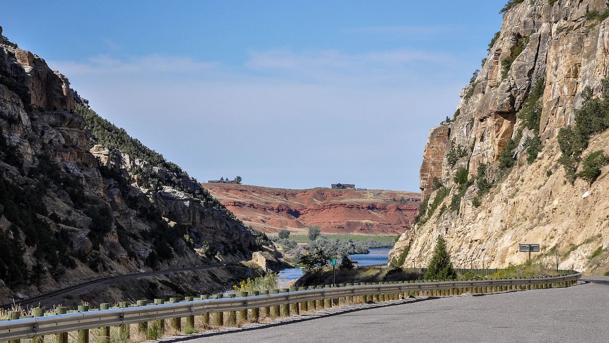
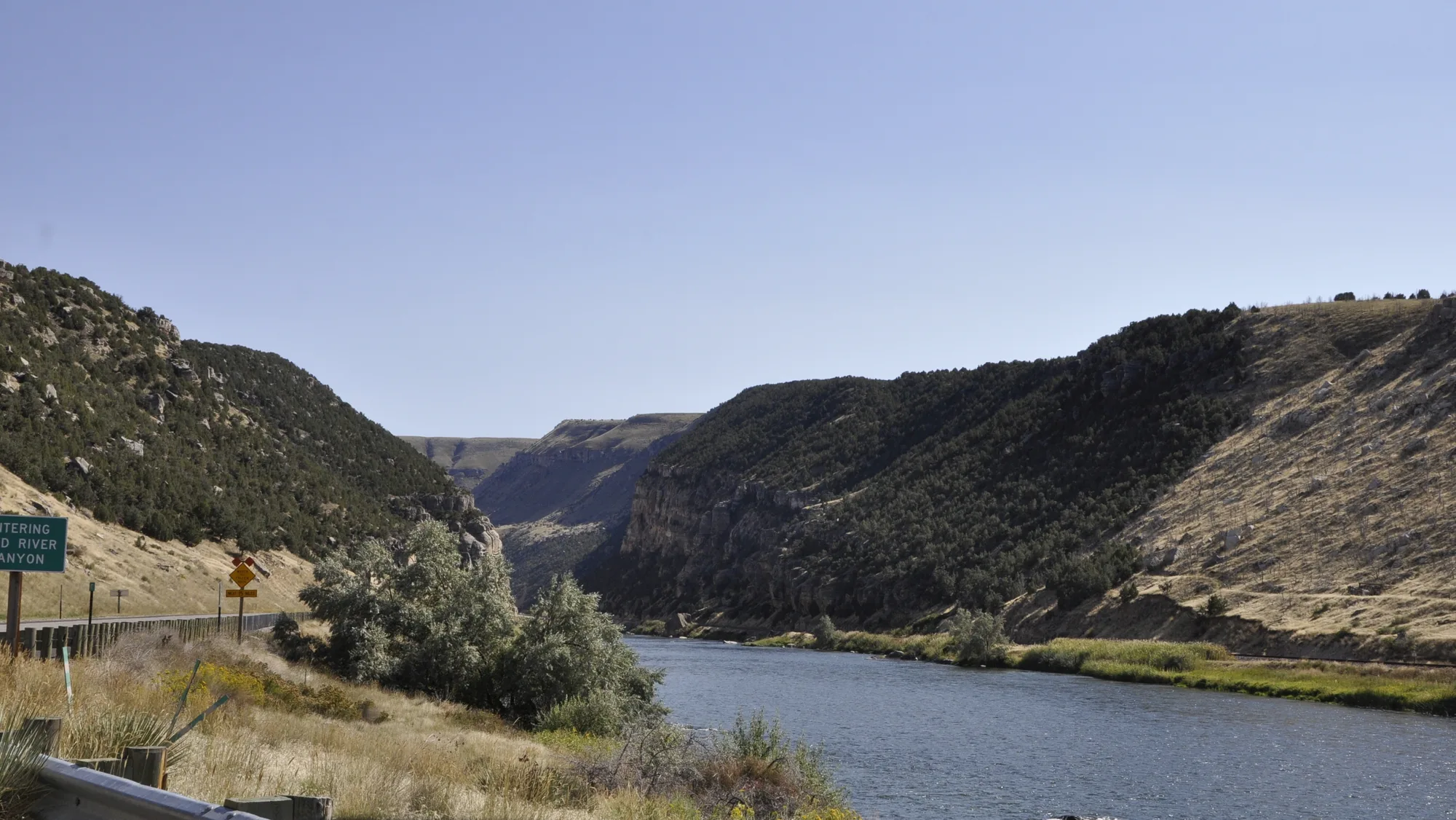
North of the reservoir, the Wind River cuts through the Owl Creek Mountains. Roadside geology markers help make sense of the changing formations, but you do not need to memorize a timeline to appreciate the display: different colors, textures and angles reveal that the walls were assembled over immense spans of time.
Let a passenger read the landscape while the driver watches the road. If a marker or view catches your eye, stop only where there is a designated, open place to pull completely clear of traffic. Narrow shoulders, curves and falling rock make improvising a photo stop a poor trade. From a safe pullout, look across the river as well as upward; water, road and railway share a remarkably tight passage.
The canyon's appearance also changes with the light. Morning and late afternoon can bring out different colors in the walls, but darkness and bad weather make an unfamiliar, winding road more demanding. Plan your schedule around conditions and your own comfort rather than chasing a perfect photograph.
4. Take the tunnels at the road's pace
The highway passes through tunnels as it squeezes along the canyon. Keep a steady speed, obey posted signs and give larger vehicles room. Turn on headlights where required, remove sunglasses if visibility calls for it, and avoid stopping for a picture in a tunnel or in a travel lane.
Travelers in a tall or wide motorhome, trailer or commercial vehicle should check WYDOT's current route restrictions before departure. Tunnel clearance, roadwork and special vehicle requirements can affect a trip, and the right time to find out is before reaching the entrance. The same check is useful after storms or freeze-thaw weather, when rockfall or other hazards may affect the route.
5. Find the Wedding of the Waters
Near the north end of the canyon, a place called the Wedding of the Waters marks a geographical curiosity: the Wind River becomes the Bighorn River. The water does not turn around or begin a separate journey there; it continues north under another name. The National Park Service describes this transition as the point where the river emerges from Wind River Canyon.
Make this a planned stop only if the signed public access is open and you can park legally. Take in the change from canyon walls to a wider valley, and resist the temptation to reach the bank from an unmarked shoulder. Anyone planning to fish or float should check the correct jurisdiction, access points, current flows and license requirements in advance; nearby private and tribal lands have their own rules.
6. End with time in Thermopolis
Thermopolis makes a natural northern bookend for the drive. Hot Springs State Park gives visitors a chance to stretch their legs and explore a landscape shaped by mineral-rich thermal water. Check the park's official information for current facilities, hours, rules and any bathing arrangements before making a soak the centerpiece of the day.
Leave enough time for a meal in town or an overnight stay if you prefer not to turn straight around. A relaxed schedule also gives you the option to return through the canyon in different light, provided road and weather conditions remain suitable. Keep in mind that sunset, winter weather and changing road conditions can make a return drive feel different from the morning trip.
7. Treat the route as a living homeland
The byway passes through the Wind River Indian Reservation, home to the Eastern Shoshone and Northern Arapaho peoples. Traveling on the public highway does not turn adjacent land into public recreation space. Stay on authorized roads and in signed visitor areas, respect private property and posted restrictions, and leave gates as you find them.
If you want to fish, hike or otherwise recreate on reservation land, contact the appropriate tribal authorities before going and obtain any required permits. Requirements can differ from Wyoming's state licenses and rules elsewhere along the river. A little advance work protects both the place and the experience, and makes the drive easier to enjoy without uncertainty about access.
Before you go
Check WYDOT's road conditions and the Wyoming State Parks website immediately before your trip. Carry water, keep a full enough fuel tank, and make room in the plan for weather or unexpected closures. The scenery is the reason to come, but reaching each stop safely is what lets you enjoy it.